|

|
Winter Creek
|
|||||||||
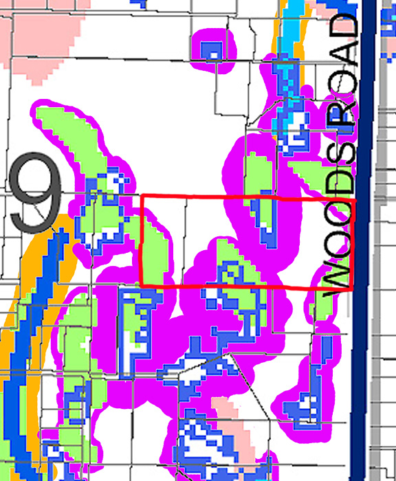
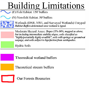
| Starting with a building limitation map of Kitsap County, I've cut out the section that deals with our forest and the areas around it. I have then overlaid theoretical buffers. The original map lacks fine detail and so there is some variability in the buffers. I also know that at least one stream is missing from the GIS data. | |||||||||
|
|||||||||
| These buffers are similar to those I've mapped based on local surveys | |||||||||
|
|
|||||||||