|
Winter Creek
|
|||||||||
|
Satalite Images of the Surround Area
|
|||||||||
|
|
|||||||||
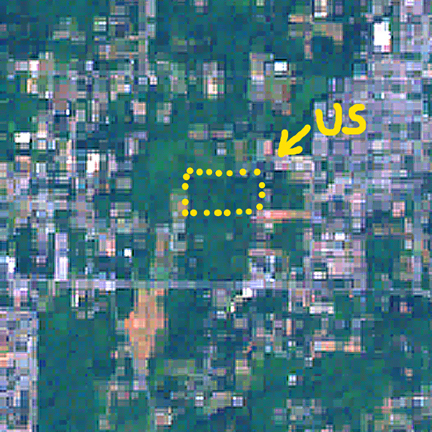
| Yellow arrow Points to our forest. Though this area is still "green" it is easy to see that it is geting squeezed between between growing erban areas. Also the color of green is important. Forest is dark green while grass fields, lawns, clear cuts and golfcorses are light green. Forested areas are less common. | |||||||||
|
|||||||||
| A closer view of our forest. | |||||||||
|
|
|||||||||
|
|
|||||||||
| I don’t know who produced the original satellite image. These are only a small part of a wider image. |