|
|
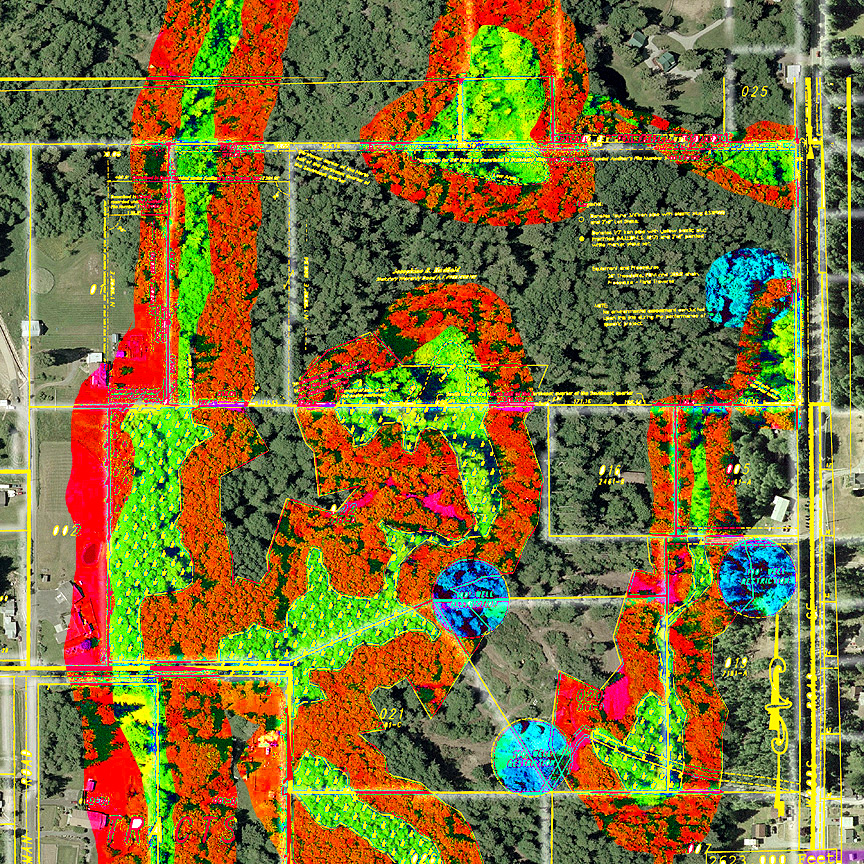
Winter Creek
|
|
|
Survay Results 0verlaid on Areal Imags
|
|
| This false colored image shows layers of data from several sorces. On top of that it has some downright guesses on my part. There is much I don't know about the path of surrounding streams or the spread of surround wetlans I don't honestly know the exact spread of streems and wetlands on our property. I've attempted to take what I do know and what I guess and present them here to start thinking about what needs to be managed and how. To start thinking where we could build a home and what needs to be protected. The wetlands are in green, their buffers in orange and well sites in blue. |
|
|
|
|
| Image |
Ledgend |
|
|
|
|
Wetlands* |
|
|
|
|
Wetland Buffers* |
|
|
|
|
Well Buffers* |
|
|
|
|
|
|
|
|
|
|
| * I am using layers of servays to show where known wetlands and wells are. I have then taken the lead of those servasys and attempted to interpret what it means for the surrounding area, including our forest. This is an educated guess and likely has major flaws. The well that is on our property has been hidden since the 1970s and so is only a guess. The wetlands on the surrounding areas are guesses baised on the fact that the water that runs down stream from our property must go somewhere and come from somewere. Click here to see more of the layers that when into this page. |
|
|
|
|
|