|
|
Winter Creek
|
|
|
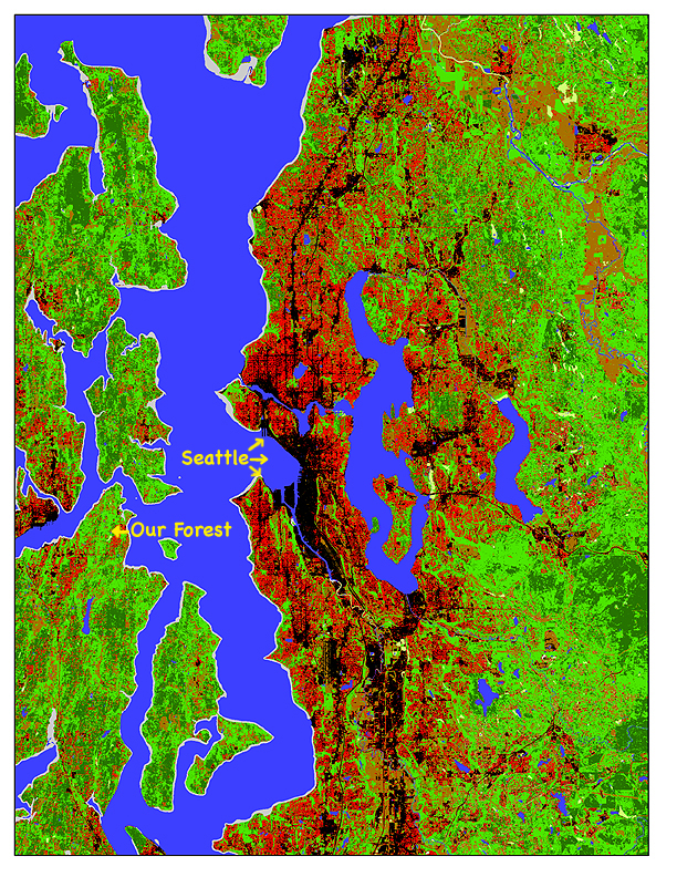
Landsat Thematic Mapper Satellite Image
|
|
|
|
| from |
| http://www.nsf.gov/news/mmg/mmg_disp.cfm?med_id=57015&from=googlebot(at)google.com |
| related to http://www.urbanecology.washington.edu/index.html. |
|
| Taken in June 2002, this image showing land cover for central Puget Sound. Dense Urban (75% Impervious Surface) are in Black; light-medium urban area (10-75% impervious surface) are in Red; agriculture/grass in brown; mixed and deciduous forest in light green; coniferous forest are dark green; wetlands light green; shoreline gray; water blue. |
|
|
|
|
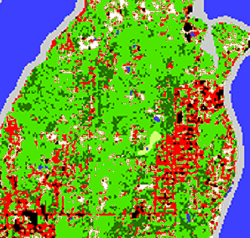
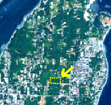
| The image on the left is a closer view of the area around our forest. In this image I've changed the agriculture/grass areas to white instead of brown so they show up better. On the right is a satellite image of the area with a yellow arrow and dots marking where our forest is. As our forest is a mix of coniferous and deciduous forest is shows mostly as light green. It is easy to compare the two images and see the spread of houses tracks with the increase of impervious surfaces. The increase of red and black areas mean the decrease of areas for wildlife. We do see a green corridor still running down the center of the map, so there is hope. |
|
|