The Collected Adventures of Chris Dessert and Various Cohorts!
Mt. Rainier - Kautz Route 5/20/06
The plan was to 'scout out' the Kautz Glacier route for a future summit attempt of Mt. Rainier. In case the weather gods blessed us we would bring enough gear to make a summit attempt. Neither I or David had been up this route, and from what we heard it requires a bit more technical experience than some of the easier routes up Rainier.
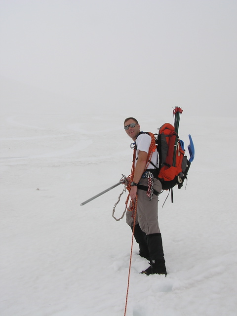
So we drove up early Saturday morning. I couldn't find my gortex jacket so we had to stop by the Summit Haus in Ashford so I could rent an RMI gortex jacket. At the parking lot we began to cycle through our gear. It was really foggy so we were expecting some route finding difficulties. I figured why bring the sunblock with this weather (guess who got panfried?!). We planned out the route.
Route Plan:
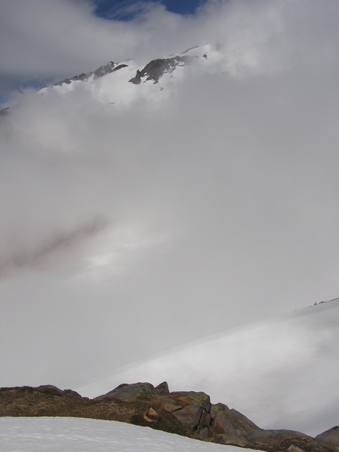
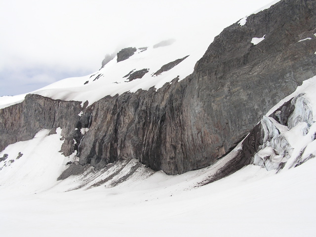
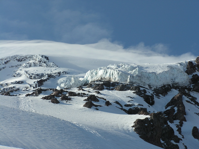
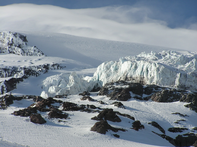
It began along the Skyline Trail and heading west just before Panorama Point, crossing the bottom of the Nisqually Glacier. Once across the usual route would be to head up a snowline to the left of a big rock formation called "The Fan". Recent reports advised bypassing "The Fan" to the right and getting onto the Wilson Glacier instead. Crossing the Wilson onto Wapotewy Cleaver and riding the cleaver straight up to Camp Hazard, which is quite distinctive because of the enormous Kautz Icecliffs seemingly looming right above the camp. It is advised not to use Hazard as ice debris from the icecliffs can invariable fall directly into the camp. There are many campsites above and below Hazard, which are more often used. From Hazard there is a chute with a couple of pitches of ice on steep to moderate slopes that constitute the technical difficulty of this route. We wanted to get a good look at this chute, in preparation for a future summit attempt.
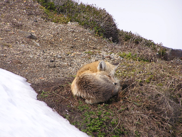
So we headed out towards Panorama Point. It was quite foggy but the snowpath was clearly defined. We came across two RMI groups huddling together, and since RMI trips always stop just below Panorama, we figured that's where we were. So we started taking compass bearings into the fog and diverged to the west. Just before we got to the Nisqually we spotted a ball of fur huddled on a rock. What I thought was a marmot was actually a fox. It knew we were there with it's ears perking up, but it let us get pretty close anyways. I guess keeping warm was the priority over a couple of intruders wandering in from the snow.
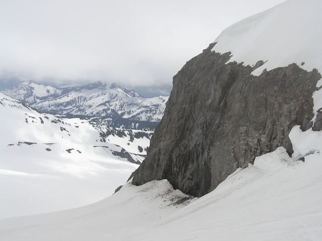
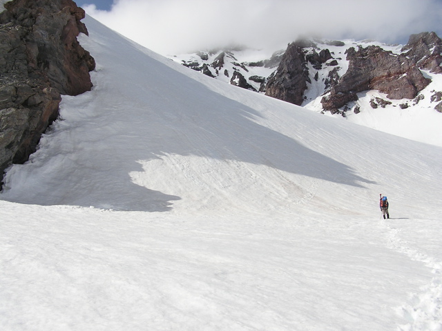
We soon roped up and headed across the Nisqually. Though it was still fogged in, there were occasional sunbreaks that allowed us to verify our route was correct. We stayed pretty true to our compass bearings just about the entire time. So we got to this big rock formation, which we assumed was "The Fan" rather than head up and over it we decided to ascend further up the Nisqually and cross over onto Wilson Glacier. Another party of 5 climbers soon caught up to us. This was great as we were able to compare notes. Since the path hadn't been kicked out we took turns with this group kicking steps into the snow.
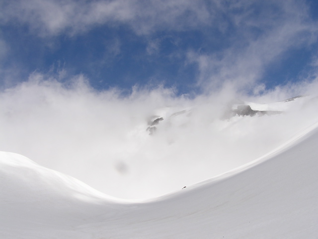
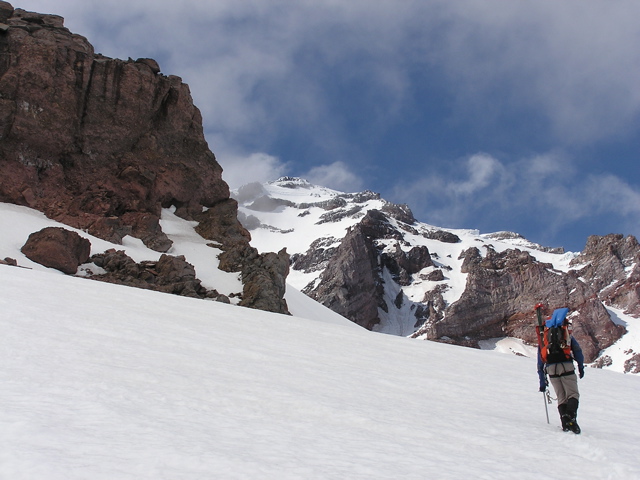
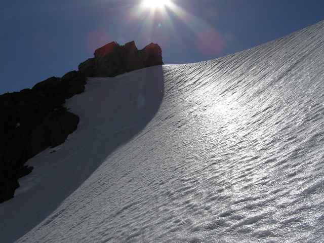
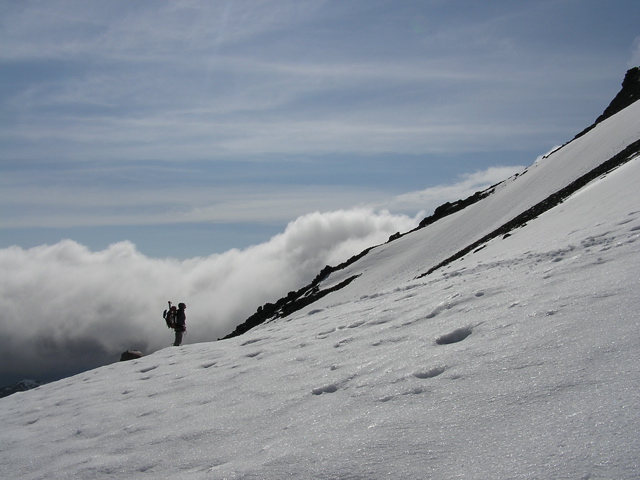
We negiotated the first steep slope of snow, which put us onto the Wapotewy Cleaver. The other group had stopped, so Dave and I moved ahead to kick out a path up the cleaver. After another 500 ft we looked back and the other group was gone. We figured they decided to turn back. Kind of smart, but we were too stupid and determined for that 'turning back' nonsense. At about 8500 ft we got our first views of Camp Hazard. It was a pretty amazing and imposing site. Just looking at the icecliffs above the camp made the decision real easy to camp elsewhere. We got to 9400 ft, to pretty strong winds. I was definitely getting tired, so we debated on whether to ascend further. On trips like this there are a number of options you mull in your heads.
Do we descend another 1000 ft higher and find a better camp? Do we have enough energy to summit? If we do summit, do we bring all our gear so we can descend down an easier route? How about we camp here and save tomorrow just to scout out Hazard? We had a defined goal of taking a look at Hazard and the ice chute to the summit and decided to stick to that.
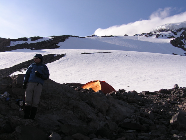
So we camped at 9400 ft. The winds were so gusty I couldn't put up the tent and get in fast enough. I knew that camping this low pretty much made the summit a non-option, but all the variables seemed to favor this choice. Not wanting to give up entirely we decided to set our alarms for 2 am and review again possibly going for the summit.
We didn't sleep very well and 2 am finally came. David seemed motivated to try for the summit. I got out of the tent and the night was clear and brisk. God was it windy though! I wasn't feeling entirely recovered from the hump up to this point, and we still had a number of steep slopes to ascend. I was a little concerned with the windspeed combined with ascending feeling semi-fatigued. My heart really wanted to go, but my head was telling me something different. I was also worried whether we would have enough energy to descend back down from the summit safely. Since we didn't get a chance to see the ice chute near the icecliffs yet, it just seemed there were too many variables to account for. So we nixed the summit attempt.
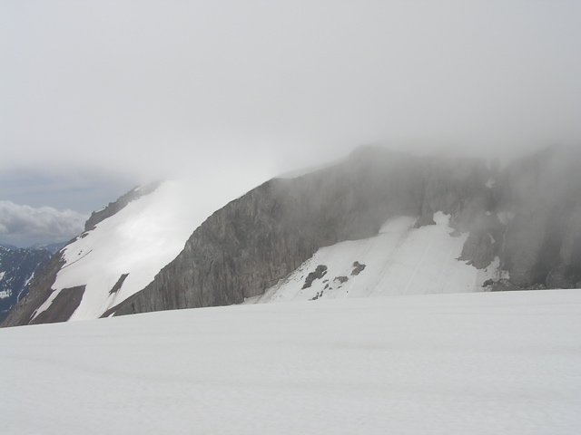
We finally got up at about 6 am and decided we have enough time and energy to head up to Hazard. We were disappointed about the earlier decision so we wanted to make a good effort of it the rest of the way. The slopes were nice and crunchy, perfect as we cramponed our way up. There were some steep sections going up, taxing the calves as we pushed further. We got to about 600 ft below Hazard but couldn't see anything as the fog rolled in. We knew the general direction we had to go, along the left of a line of avalanche debri. But it looked like the weather was deteriorating and it wasn't going to be very useful with this amount of fog covering everything. It took some effort just getting to 11,000 ft. To be honest, I was worried about getting down safely the steep terrain we just ascended. So we headed back down.
We descended back to camp. We didn't get to Hazard or the summit, but we both agreed that when you put in a good effort the goal didn't really matter as much. We packed up and began the descent back to Paradise. As we headed down the weather really took a turn for the worst, as light snow turned into a constant rain, soaking everything. Above the fan we crossed paths with a group of climbers in deep 'contemplation' on whether they planned to proceed higher. The snow was pretty ideal for the descent. We got a couple of good glissades going. The rain was not letting up, so it was surprising to see many skiiers and hikers on the lower slopes of the mountain.
So the lesson here is bring sunblock. I've already began my first line of questioning of variations of "what happened to your face" and will continue this for the next few days. Don't let this happen to you. About the Kautz, it's a longer trip, and probably would be best with a team of at least 3 people. The snow conditions need to be right to go up some of the steeper slopes. Also, carrying all of your gear to the summit and descending down a safer route (ex. Deception Cleaver) seems to be the prefered option. Unless you are comfortable descending down steep to moderate ice. It's a great route when doable, and would be a worthy accomplishment getting through it.
Last modified: 5/22/2006 12:24 PM