Day Five: Indian Creek Bridge to Napeequa River
Thanks to the scouting party from the previous evening, we made our way without any mishaps across the log bridge of the White River. Bob admitted that the adrenelin was pumping as he crossed the river. But we were thrilled that we had saved four miles, since we knew that this day was going to be a tough one. We were supposed to go up 3,800 feet in six miles, then drop 2,000 feet in three miles to a wild river.
We were in the best of moods as we set off along the White River trail. The day was sunny and our packs were lighter than ever. But Chuck, who had been up to Boulder Pass before, warned us that it would be a very hot, dry, and steep trail. He was right on all accounts.
As we turned on the Boulder Creek trail, we found that the first three miles were forested. Although we were going up steady switchbacks, it wasn't too exhausting. Bob and I hiked together and gave each other as much encouragement as we could muster. At the three-mile mark there is a creek crossing, so we sat and had a snack.
After the creek came beautiful--but hot--open meadows as we made our way up the side of White Mountain to Boulder Pass. You still have about 2,000 feet to go and it feels it. In my journal, I wrote, ":Step by step, up and up, it felt like some vicious torture of Greek mythology. Like Sisyphus, I thought the task would never be completed."
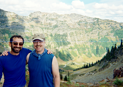
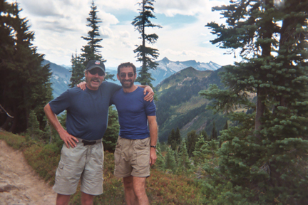
Yet, there were stands of pine trees every once in a while to cool us off, and even small streams to get more water. After hours of climbing, we reached Boulder Pass at 6,300 feet, one of the highest points of the trip. We celebrated with lots of pictures as we looked down into the mysterious Napeequa River valley, called the Shangri-La of the Glacier Peak Wilderness.
We also heard disturbing news from some southbound hikers at the pass. A hurricane was headed directly toward New Orleans and it was a Category 5 storm. Did we know what happened, they asked us. We had to say this was the first we had heard about the storm. But the news lingered in the back of my mind.
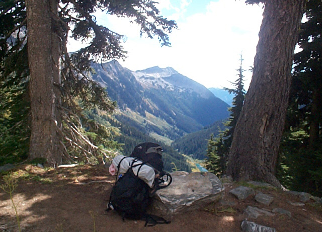
Now came a bone-jarring descent down 2,000 feet in three miles to the valley floor. As I went down, I told myself this section of trail would have been worse going up. The trail wasn't well groomed and it seemed steeper. But gravity was a great help, and before long we were at the bottom of the valley in thick woods.
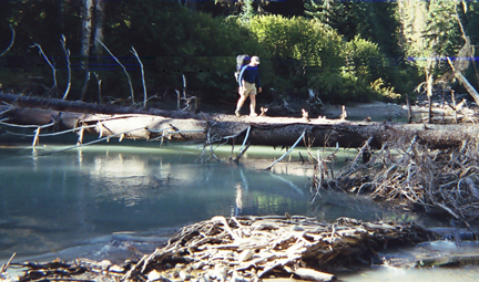
According to a trip report posted to the Internet, there was only one campsite on the west side of the Napeequa River prior to the ford. We knew we wanted to stop before the ford, since it was going to be the deepest river crossing of the trip. We planned to camp that night and cross the river in the morning, when it would be lower.
Some trail guides warn that the Napeequa can't be crossed until mid-August, but we had a very dry winter and the river wasn't as fast and deep as in normal year. Southbound hikers had already been fording it in June. Yet this was known as the most dangerous ford of the trip. The Napeequa was a glacier-fed river. It's milky waters hid the rocks underneath. We wouldn't be able to see where our feet would be stepping and its waters were ice-cold.
So we after we found the campsite in the woods, we went down about 100 yards to the river to check it out. It was running fast and sure seemed cold. There was thick brush along its banks, so it didn't seem like there was any good way to find another crossing. We all did some laundry in the sunshine and then headed back to our camp.
After all the hiking that day, you'd think we would just collapse after dinner. Instead, we sipped cognac and traded stories around the campfire. We laughed and confided in each other, as men do when they have endured an adventure together. We watched a doe come near us, looking for food and for salty urine to lick. The woods seemed wild and the world seemed very far away. It was sublime.