Day Six: Napeequa River to Alpine Meadows
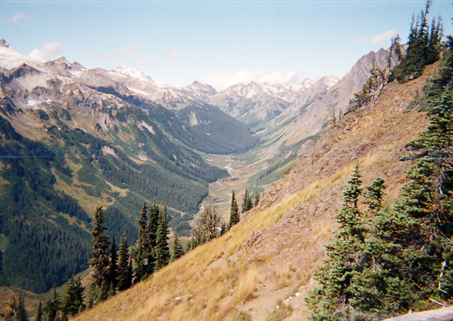
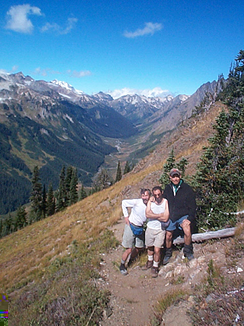
This day was the high point of the trip. We were going to travel through the wild Napeequa Valley, ford two rivers and go up and down one of the most notorious trails in the state--over Little Giant Pass. At the end of the day I wrote in my journal, "I loved the Napeequa Valley but I doubt that I will ever see it again in my life. It is so hard to get to. But it is so wild and untouched, it almost breaks my heart. This is how much of the West looked before it was ruined by the Europeans and Americans. I had to take many pictures to capture the wonder of it."
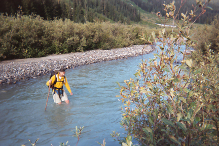
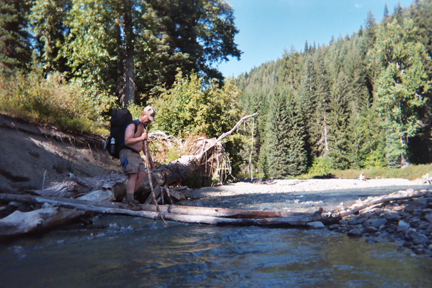
In the morning we had a quick breakfast and then looked for sticks to use when fording the river. Your stick becomes a "third leg," so that you always have two legs to anchor yourself as you cross against the current. I was concerned about the ford, but by the time I got to the river bank, Kevin had already crossed and said it was easy. While the rest changed into river sandals, I had just brought my one pair of shoes, New Balance 806 trail runners, so after taking out the insoles, I crossed the river. The water was murky and cold. It came up to mid-thigh on my 5'-8" frame. But it was a pretty easy passage and I didn't realize how cold the water really was until I climbed out of it. Some of the fords I've had to do in Yellowstone were harder than this.
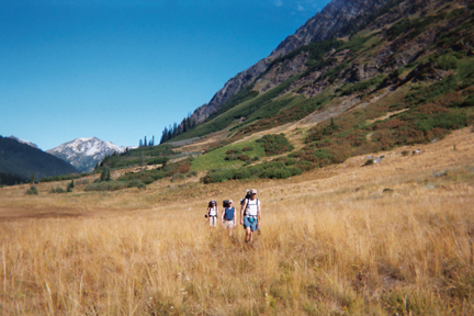
The first mile after the ford is through open meadows, where there were a few campsites and lots of water. This was easy, I thought, not realizing that it meant we would have to travel up 2,000 feet in two miles to get to the top of Little Giant Pass. My shoes dried out quickly as we climbed.
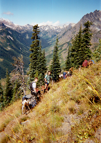
Under these circumstances we were about the hike down some of the worst trail I've had to travel with a backpack. The section down from the pass is well known for its steep tread with few switchback to soften the descent. There were long sections of nasty brush--10,000 slaps to your face and body. Add to that a stretch along a rock outcropping that was tricky and dangerous. I noted in my journal that at least we were going downhill. I would NOT recommend going up this stretch with a pack. Southbound hikers should take the unofficial detour from Buck Creek Pass to High Pass to the Napeequa instead.
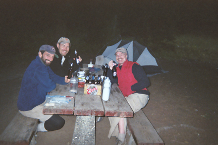
We weren't done. On the other side was a road that we had to hike about 1.5 miles to a forest service campground. We jaunted up the road feeling quite good after our day of adventure. Only one car passed us before we made it to the Alpine Meadows campground. Here was proverbial luxury--a firepit, a picnic table and even an outhouse. There were only four campsites in the entire campground--all of them empty. We chose the best spot along the river, took a bath, did laundry and relaxed.
The couple, who lived near Seattle, also told us about Hurricane Katrina and New Orleans. At this point the situation was grim, and Nancy said there would be more deaths than 9/11. She told us that 30,000 people were trapped in the Superdome and that there was looting, rapes and lawlessness. There weren't enough National Guard to patrol the city and that 15 percent of the U.S. refineries were out of commission. She predicted $4 a gallon for gas.
The whole tale was very sobering and felt totally unreal after six days of peace in the wilderness. I couldn't understand why the government couldn't save all those people in New Orleans. And I felt terrible about the loss of such a great city with its historic French Quarter and the wonderful spirit of its people. It sounded like our leaders, especially President Bush, were not doing their jobs to protect the American people.