POST
Site Report for Inferno
Contents
- Introduction
- Primary sources
- Overview of Ashes
- Orthomosaics
- Major vents on the lower half of Inferno
- Venting on crown of Inferno
- Proposed placement
- Calculating scale
- Revision history
Todo
- Add CamHD to map
5/13/19: I’ve added a second page with a closer examination of the North Face vent.
Introduction
The InVADER mechanical design is driven by science requirements on the placement and pointing of the laser instrument. Due to the project schedule and budget, and the realities of designing instrumentation for deployment by ROV and subsequent operation in the deep ocean, it is unrealistic to design a highly flexible or field-reconfigurable platform that would allow unrestricted freedom in sensor placement at the time of deployment.
Instead, we plan to use available information about Inferno to identify one or more preferred deployment sites, with the instrument then designed specifically to access those sites. Depending on the number and likelihood of sites selected, and taking into account the dynamic nature of the site, this might require some degree of flexibility in the design, if not true reconfigurability.
Identifying those preferred sites requires an understanding of the geometry of Inferno, and the location of certain surface types, including areas of concentrated and diffuse flow, precipitate chimney formation, and areas of bare rock.
Primary Sources
The primary data source for this report is HD video from the main science camera (PDF) on the ROV Jason. During the 2018 OOI Regional Cabled Array Operations and Maintenance Cruise, Jason worked at or near Inferno on multiple days, performing scientific sampling, as well as a close video survey of Mushroom and Inferno vents. All video files referenced here are listed together here. Unless otherwise noted, all images should be credited: UW/OOI-NSF/WHOI; Visions 18
The video “Survey of Inferno Vent with timecode overlay” is the primary source for the reconstructions and images shown here. The Jason video is recorded as 29.97 fps, 1920x1080, interlaced video, encoded as ProRes/Quicktime video. The ProRes-encoded file has significantly fewer video encoding artifacts and provides a better image source than the h264-encoded .mp4 videos. That said, the image quality remains quite challenging with significant sensor noise, interlacing effects, highly variable lighting, and varying exposure and color balance.
Due to the overall low image quality and interlacing effects, it can be easier to extract context from watching short segments of video rather than the still images shown here. As such, despite it’s size at ~85GB, the survey video is an essential companion to understanding the still images. Whenever possible, the screenshots here include the timecode overlay, providing an absolute reference back to the video.
It should be noted this video represents a snapshot of the vent on a single day in 2018. Its activity patterns may change significantly between 2018 and the upcoming O&M cruise in 2019, and again before the InVADER deployment in 2020.
Ashes Hydrothermal Vent Field
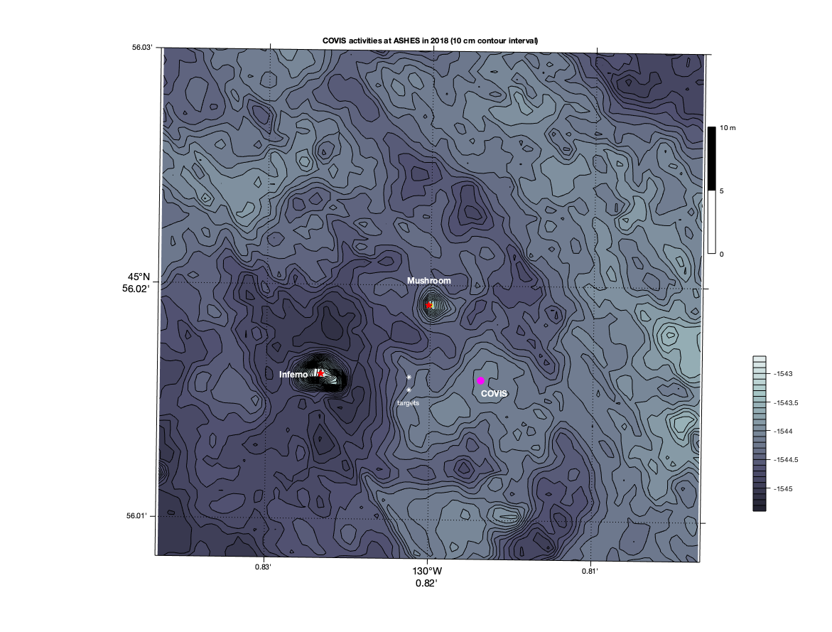
The following map shows the bathymetry within a ~50 x 50m region around the Inferno and Mushroom vents, including existing large OOI instruments COVIS and CamHD (to be added). The smaller OOI instruments (the osmotic water sampler and 3D thermistor array) and OOI cabling are not shown.
COVIS, located ~12 m due East of Inferno, is a multibeam-sonar instrument which is studying thermal flux in and around Ashes. As such, it primarily “looks at” the water around Inferno, not Inferno itself, however the impact of having InVADER within its field of view must be considered when making a site selection.
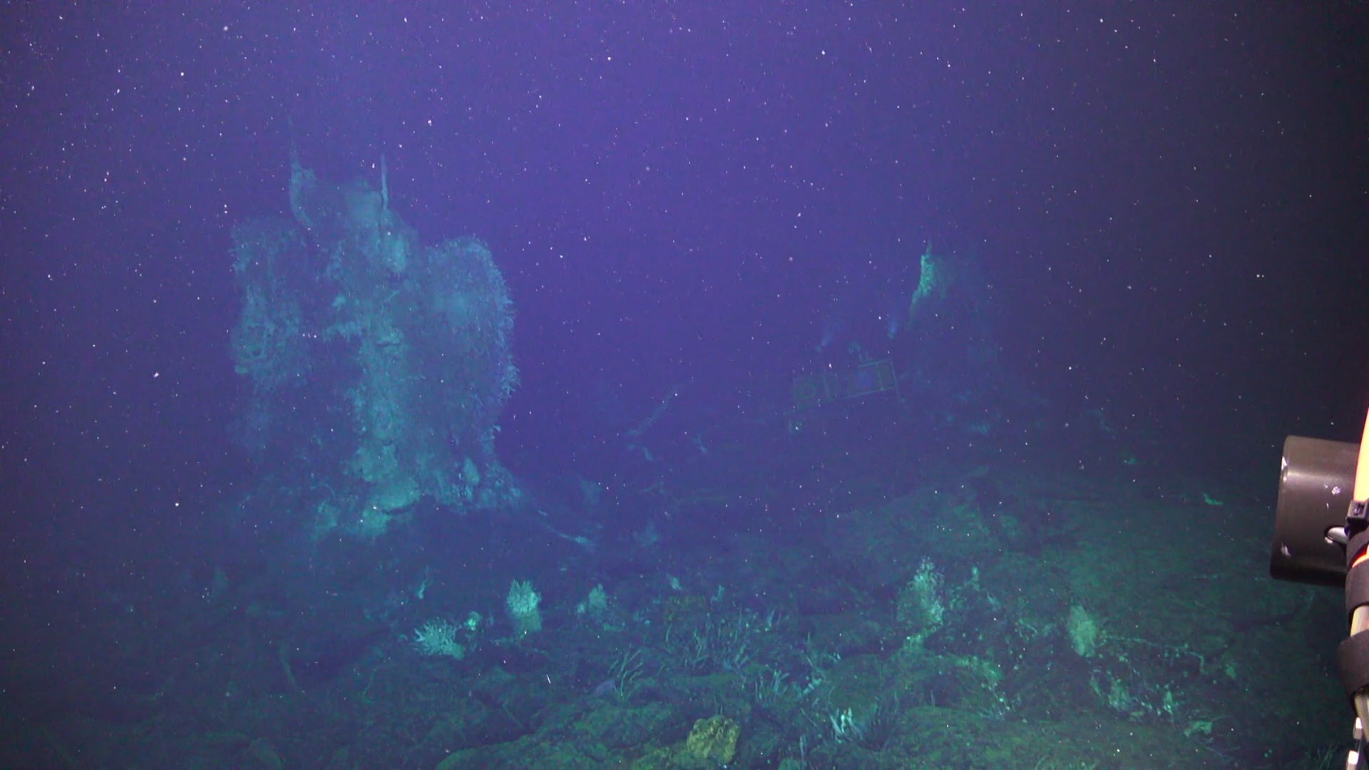
Inferno (left), CamHD (center), and Mushroom (center-right) can all be seen in this image:
CamHD’s lights are on and angled upwards, illuminating Mushroom’s Southwest flank. The ROV is approximately 8-10m South of Inferno, looking NNE at the two vents, with Mushroom ~15m from the ROV. Over these long distances, light attenuation and particulate matter in the water make image quality very poor.
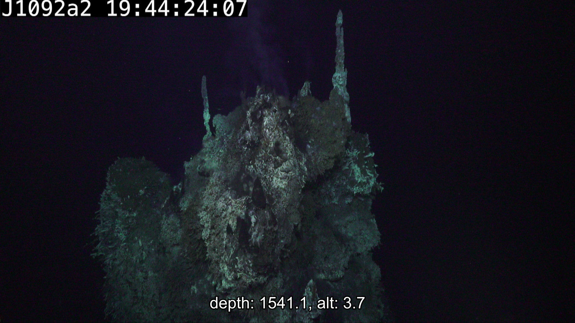
Inferno is approx. 5m in height. At the base it is oblong in cross-section with the longer axis aligned in the W-E direction, as is evident in the bathymetric map above.
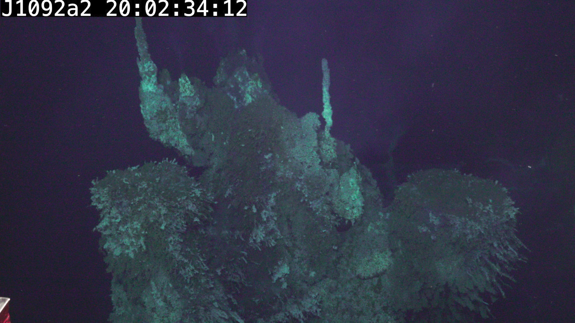 (also looking North, taken from similar location but higher altitude compared to previous image)
At approximately 60% full height, Inferno splits into three masses, the flat-topped outcropping on the East side (right in above image), and a sub-prominence on the WSW side (left in the above image).
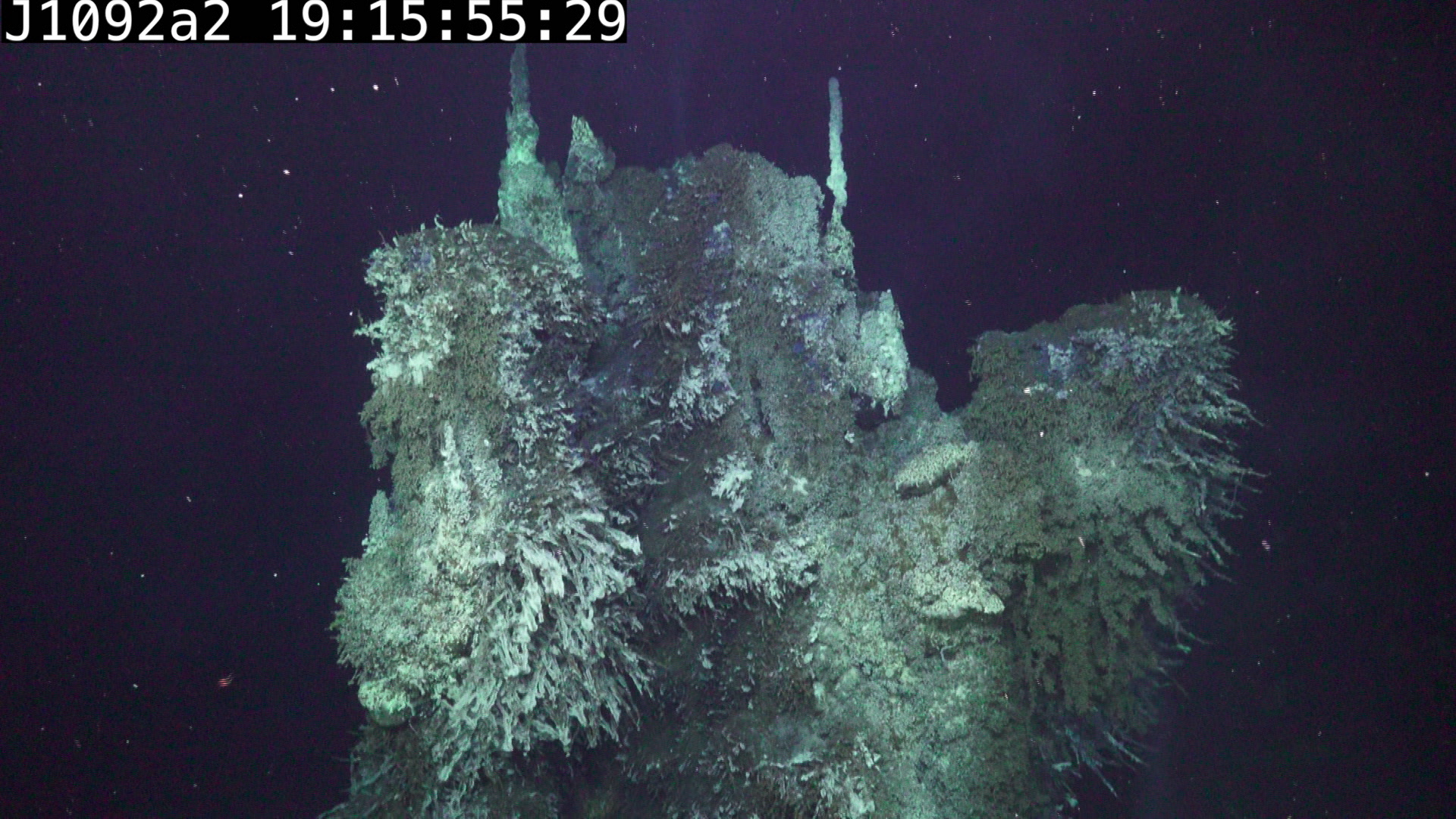
These large scale features, combined with the two prominent spires on the crown of Inferno provide landmarks while examining photos of the vent.
Orthomosaics / reconstructions
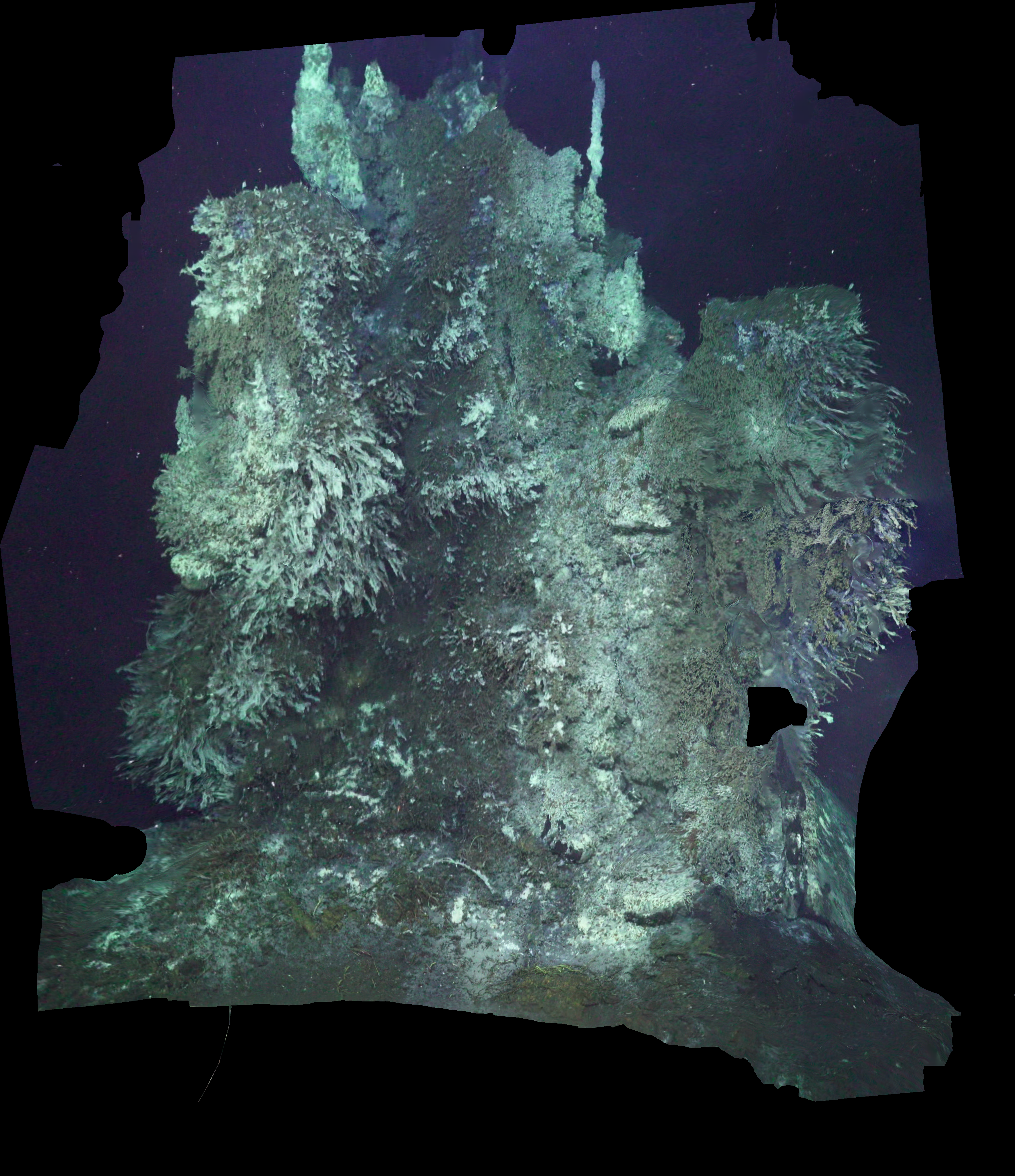
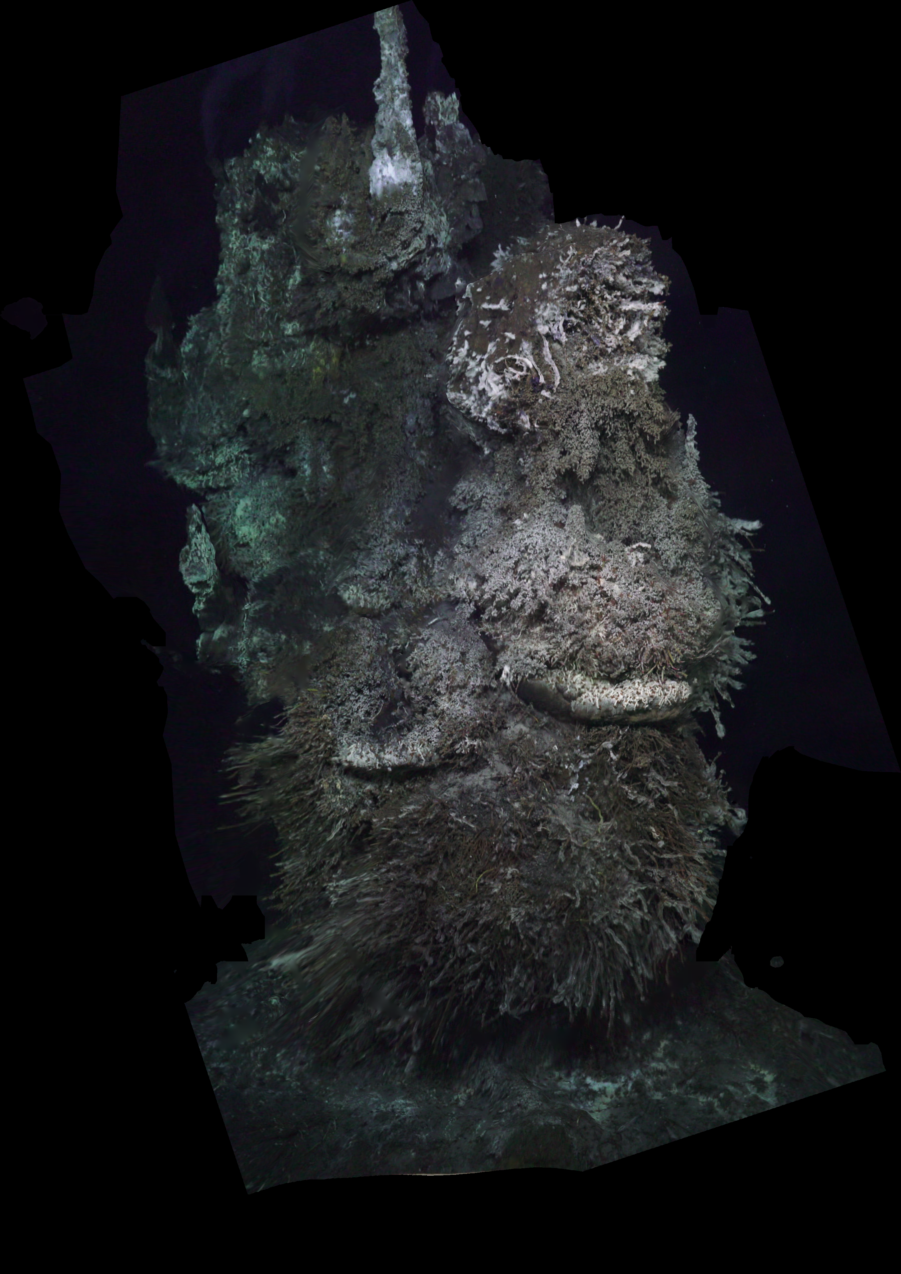
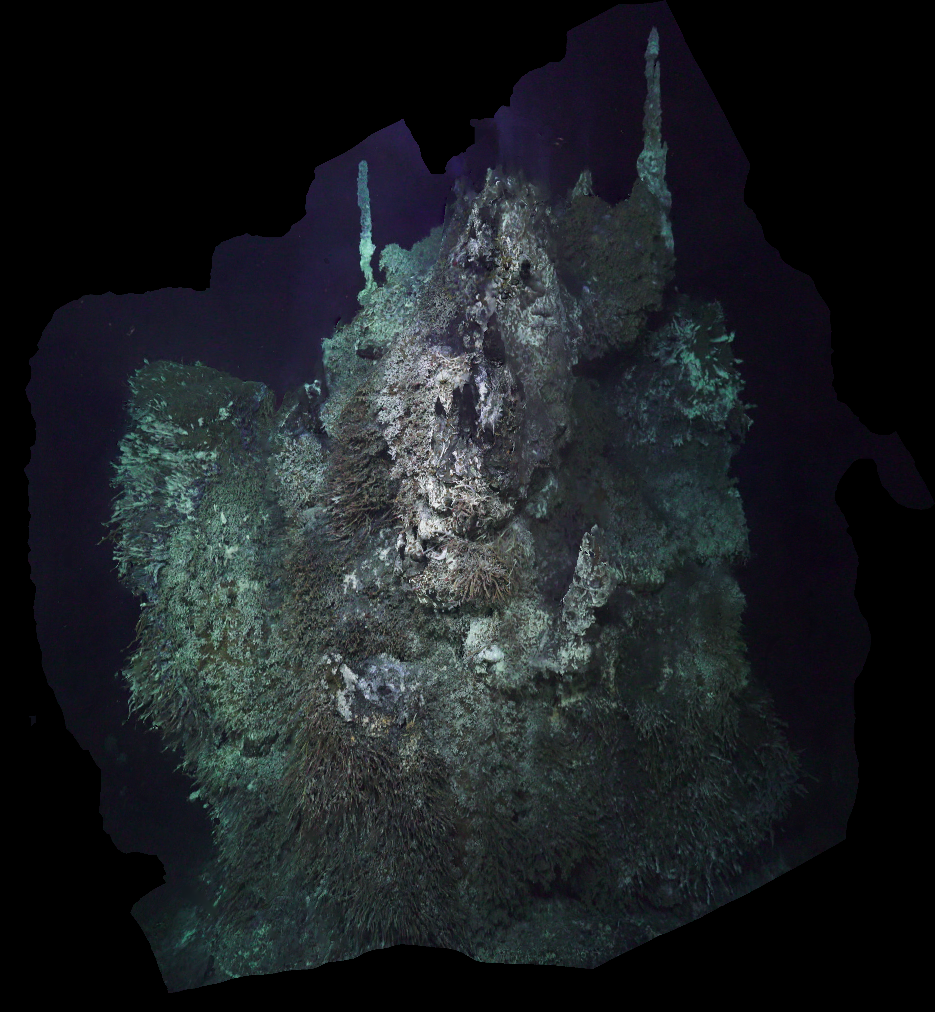
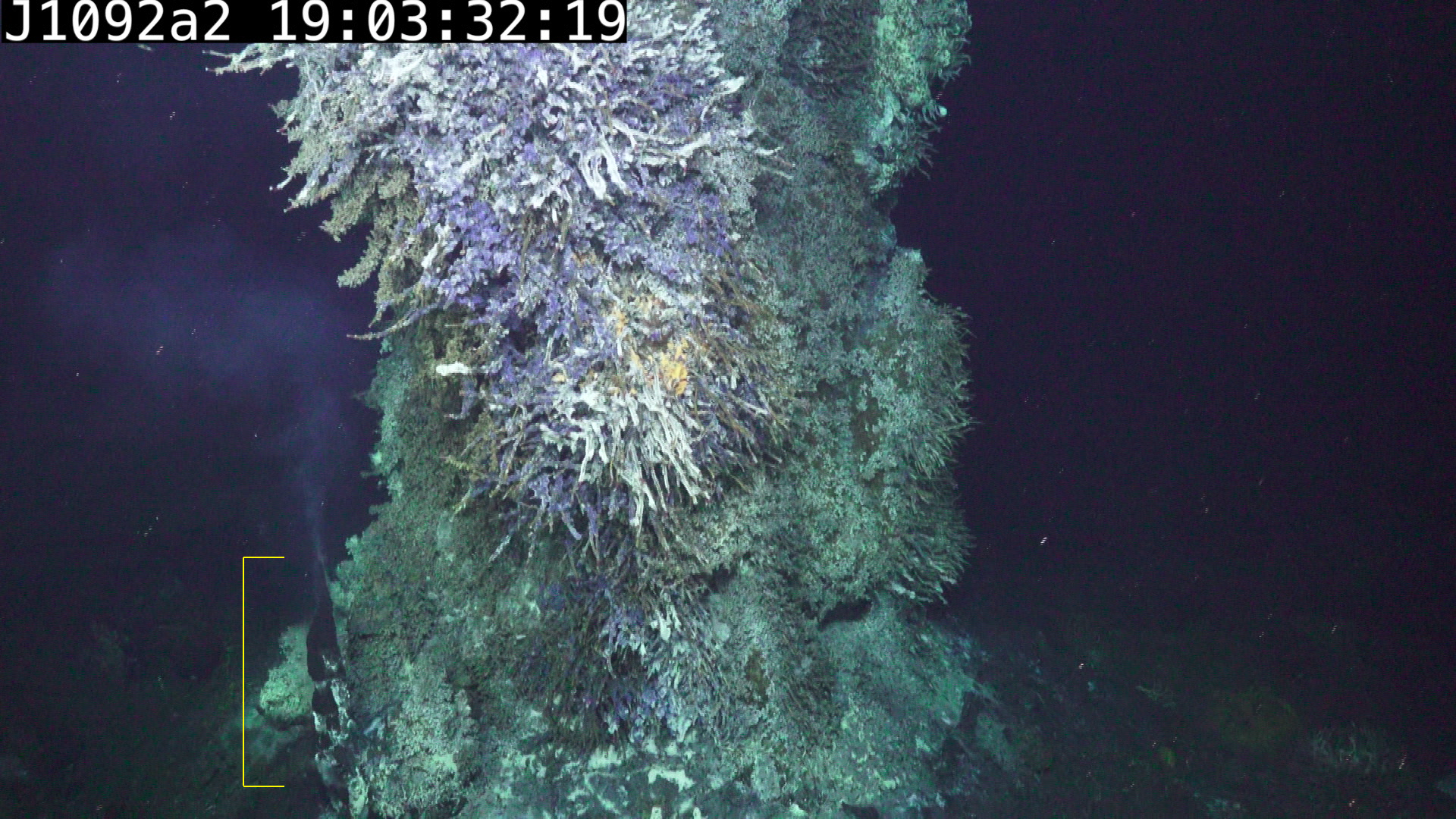
During the survey, Jason made four vertical bottom-to-top-to-bottom transects on the East, South, West and North sides of Inferno. The video segments for each of these vertical transects have the greatest internal appearance consistency and image overlap, and are the most straightforward subsets of the data to mosaic/reconstruct.
Preliminary orthomosaics for each of those vertical transects are shown below:
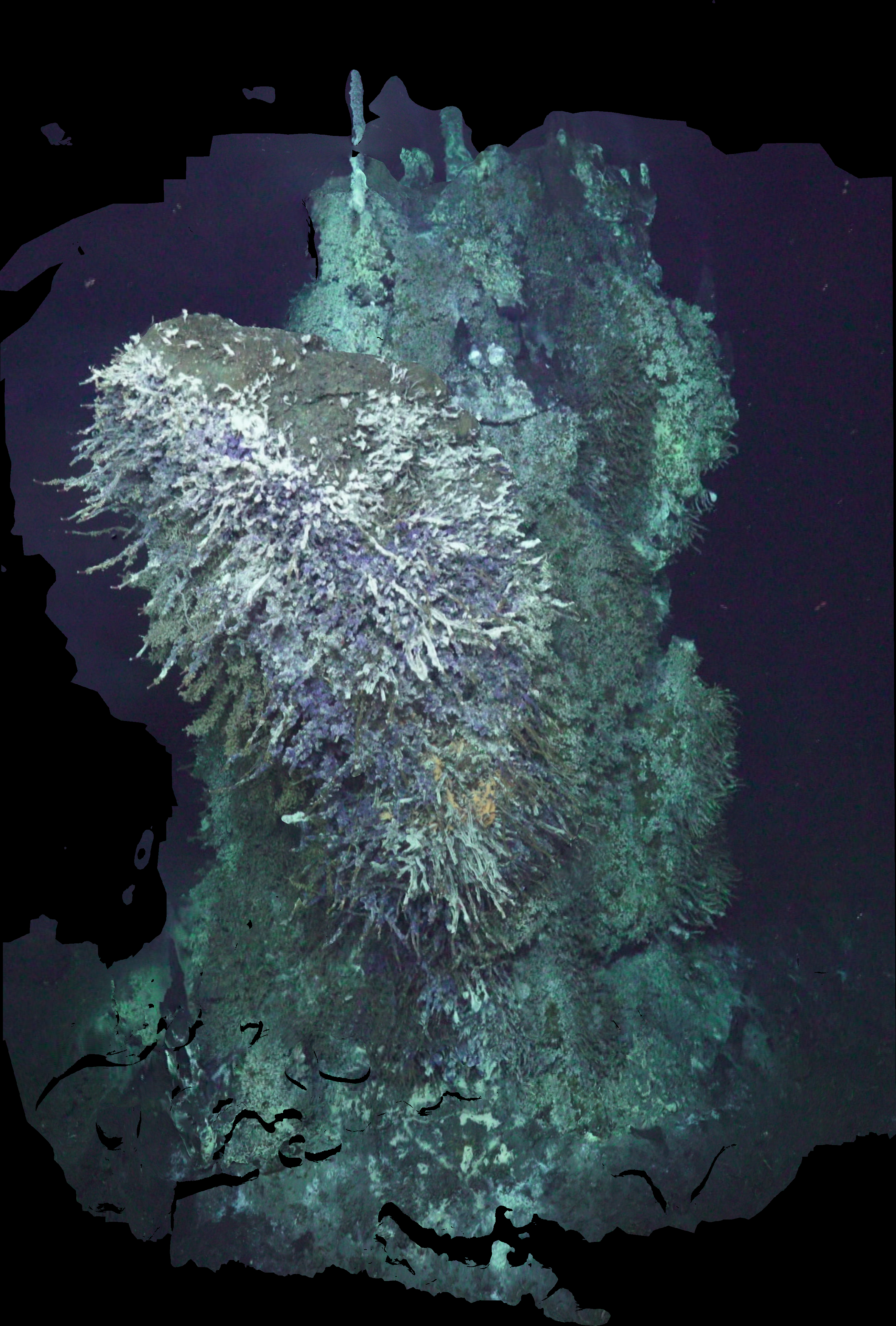
East face
The east face is dominated by the flat-topped outcropping, seen here with a dense tube worm population on its lower surface.
South face
The southern face shows the western prominence (left) and flat-topped outcropping (right). The SE base chimney can be seen in the lower right directly below a data void in the photomosaic (caused by the high-temperature distortions immediately over the vent?)
West face
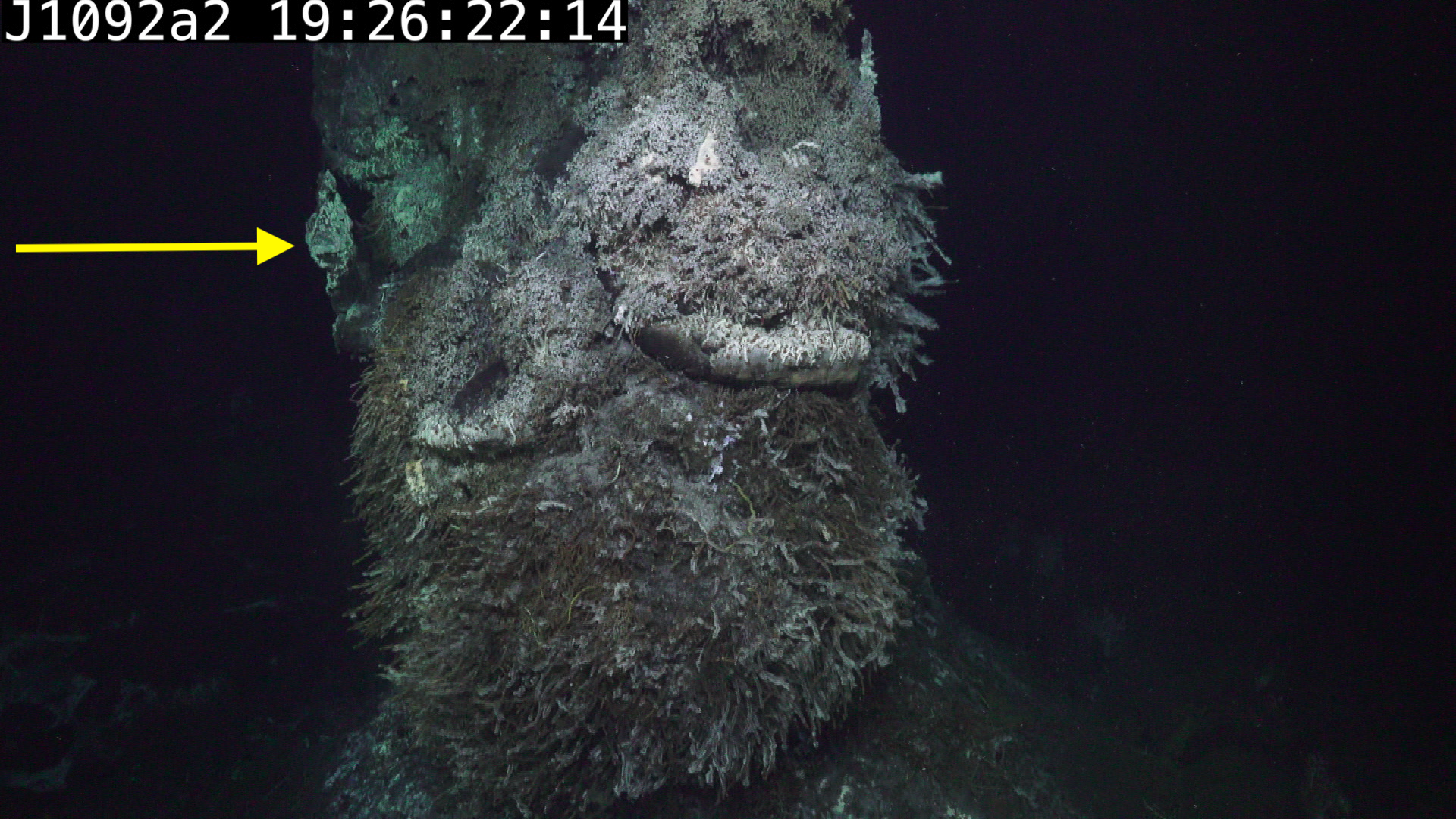
Viewing from the west shows the western prominence is in fact on the southwestern corner of Inferno, with the majority of its mass well south of the central vent. The North protruding vent is seen in profile on the left side, halfway up.
North face
This image shows the north side of the flat-topped outcropping (left).
The North face is examined in greater detail below.
JASON did not descend as close to the seafloor during this transect as in the previous three, hence the vertically foreshortened appearance.
Active Venting on the lower half of Inferno
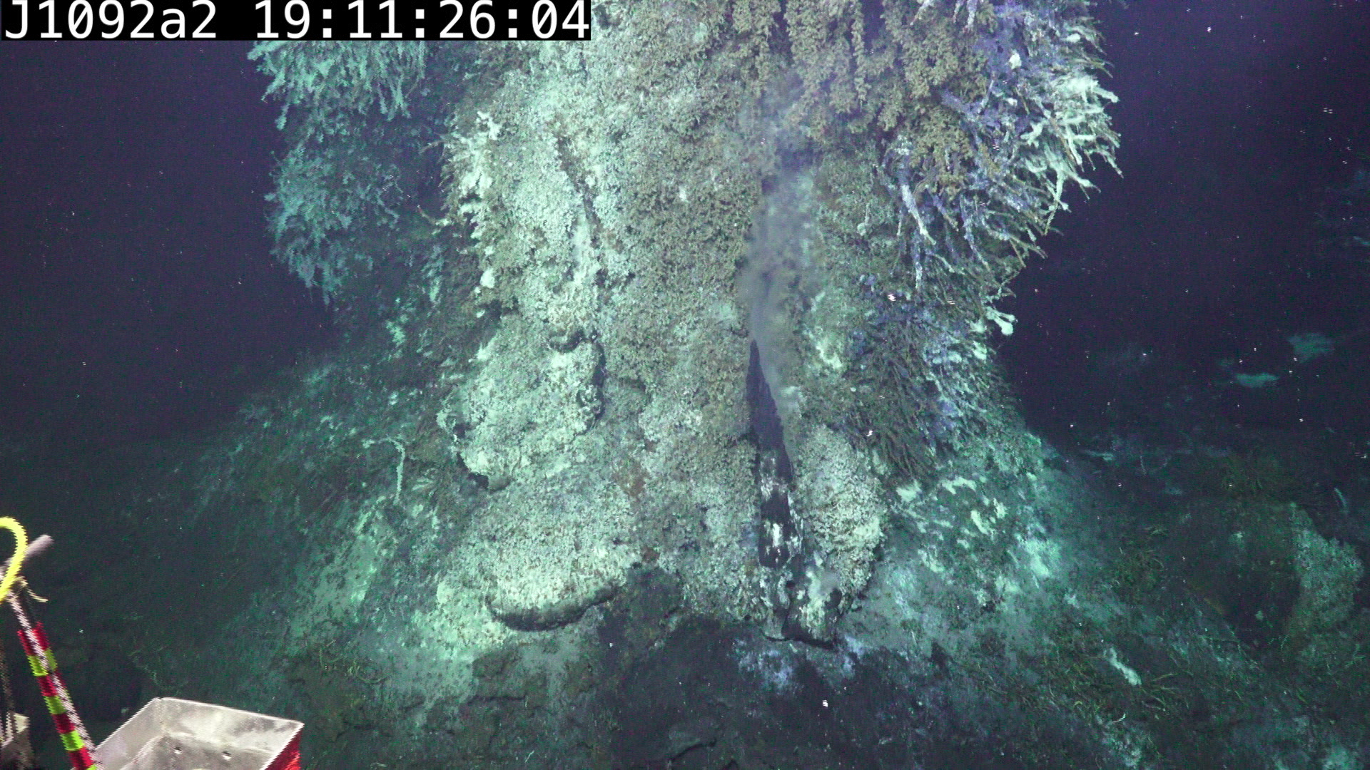
There are 2 major chimney formation sites on the lower half of Inferno.
Base vent, Southeast side
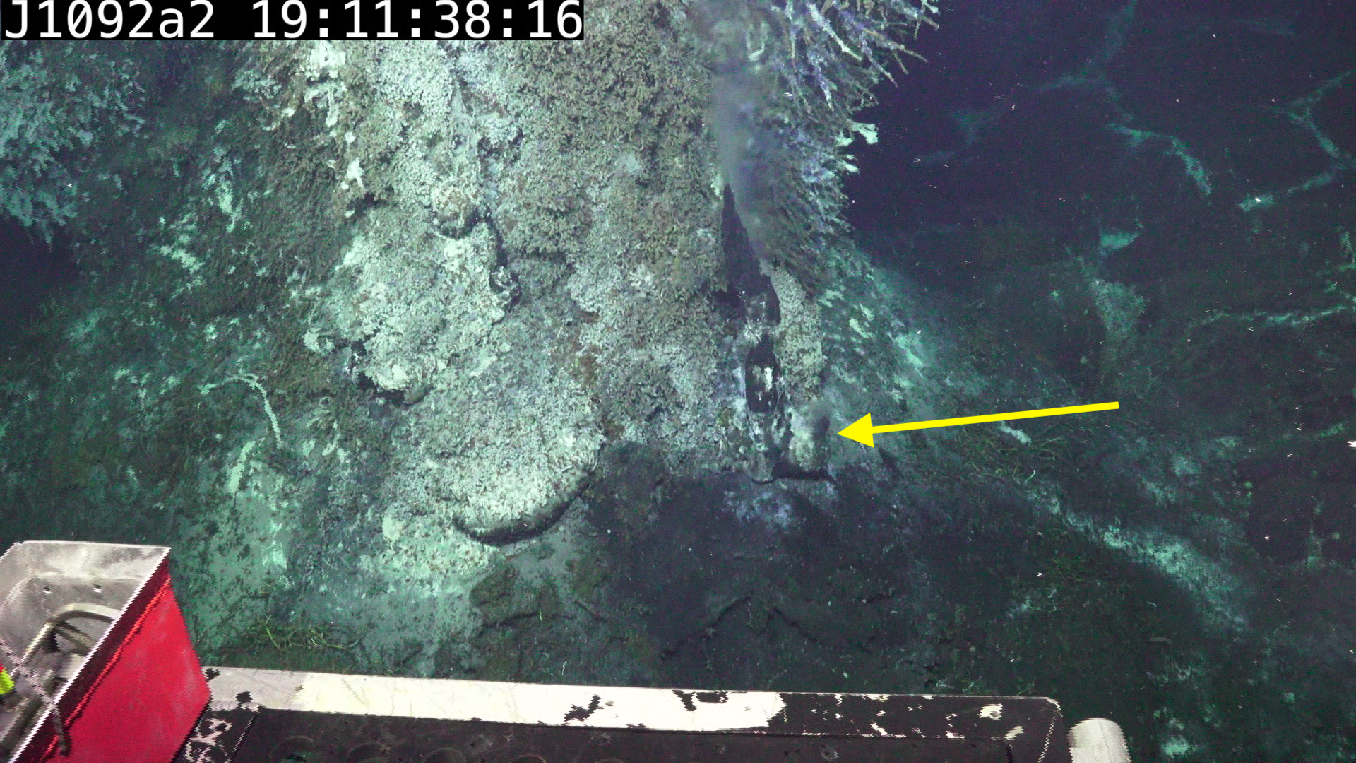
The most active vent occurs at the base of Inferno on the SE side, beneath and to the south of the flat-topped outcropping. Short video here @ 1 minute.
The vent site has produced one major chimney as well as smaller chimney at its base (yellow arrow below):
Protruding vent, North side
A second major vent extends from the North/NW face of Inferno at approximately 60% of full height. Short video here @ 15 sec.
Venting in the crown of Inferno
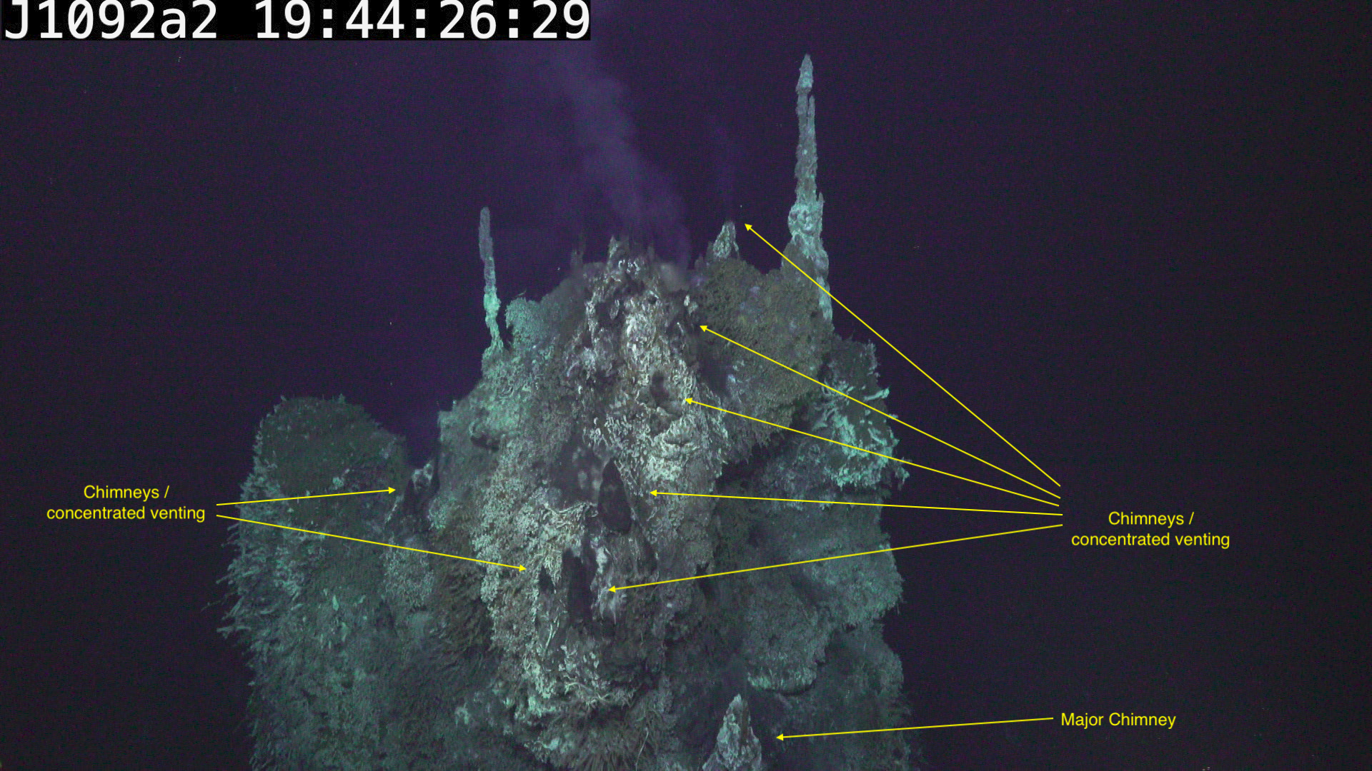
The majority the visible venting is in the crown (top 25%) of the vent.
North face cluster
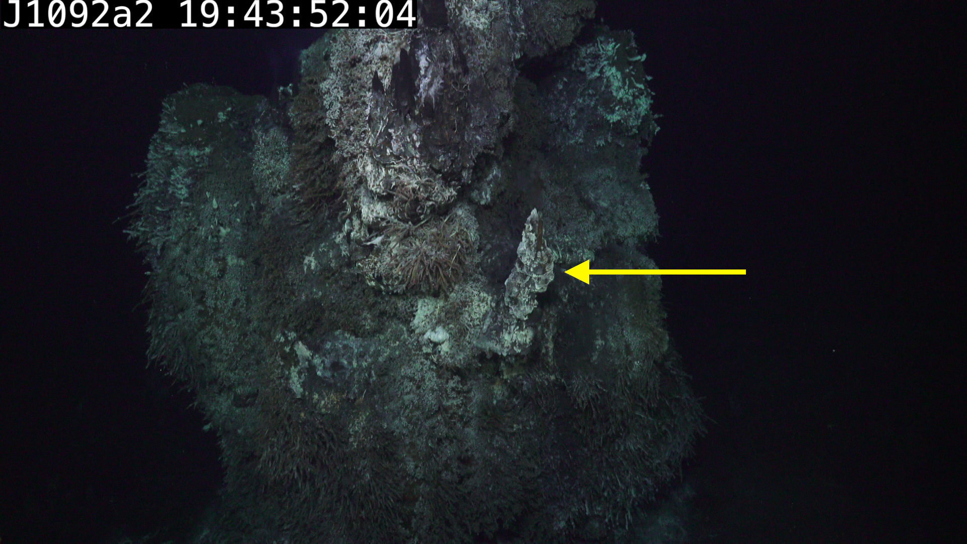
The greatest concentration of chimneys is on a prominent ridge which forms the Northern face of the crown, directly above the protruding vent described previously. Short video @ 43sec
This same region can be seen in profile below on the right side of the vent, showing the number of larger chimneys lower in the region and the high concentration of smaller chimneys near the top.
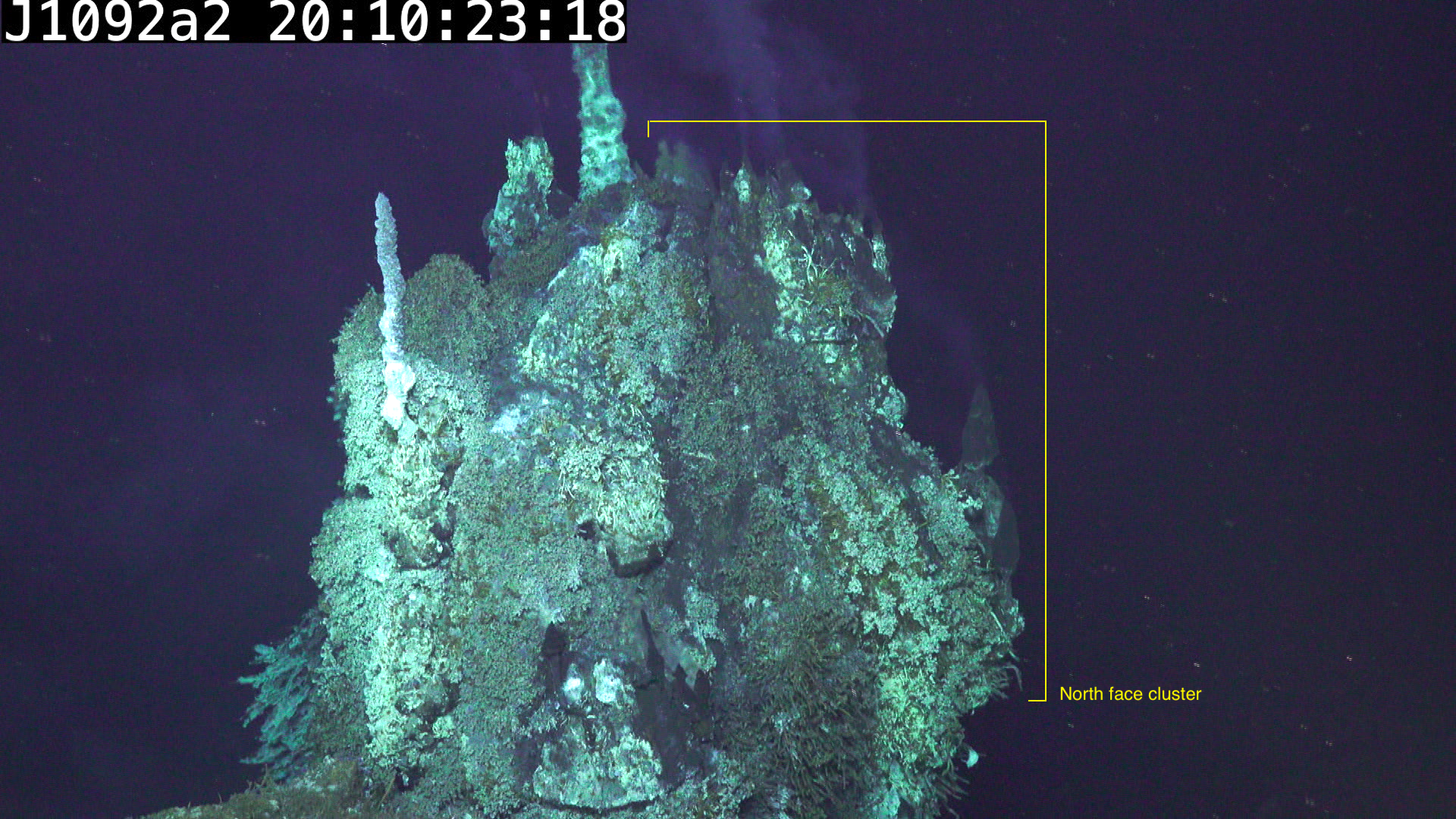 North face cluster in profile, looking West. Image has been brightened.
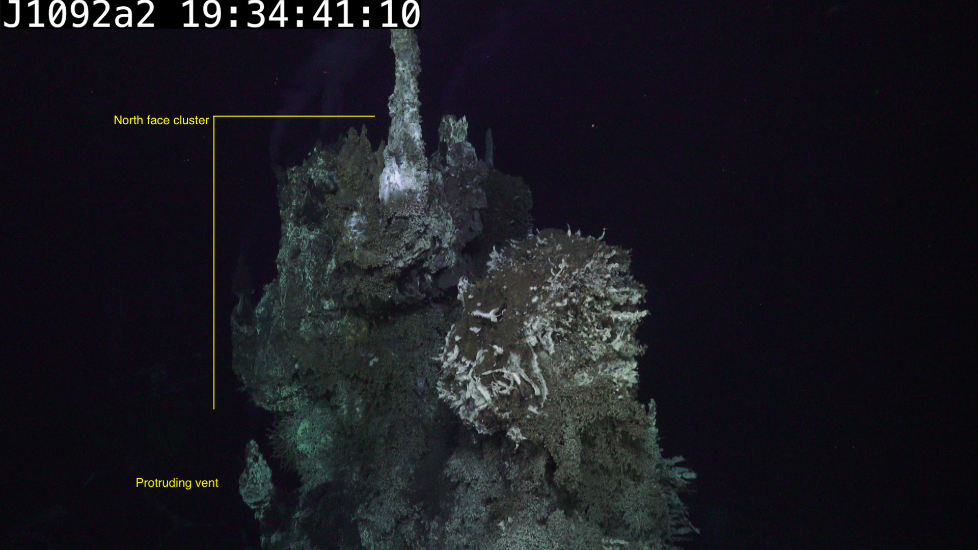 North face cluster in profile, looking East.
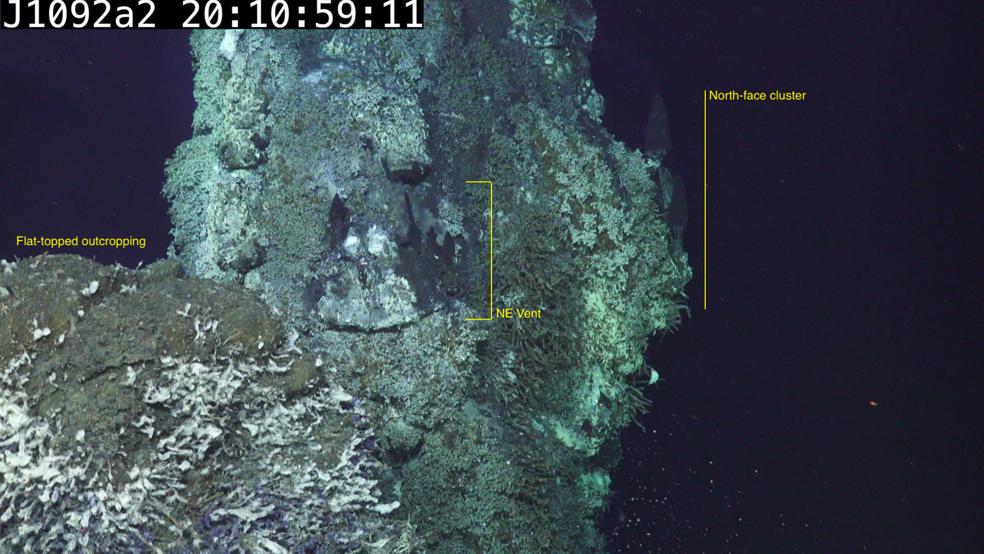
NE Vent
The NE side of Inferno hosts a second, smaller region of chimney formation, slightly “around the corner” from the North face cluster, and near the division between the main vent mass and the flat-topped outcropping. This region of chimney generation is much smaller than the region on the North side, but sits in a concave bowl which might make access to multiple surface types more straightforward.
SW Vent
There is one further major vent found on the south side of the central tower, near the tallest spire on the vent. In this video it has significant direct venting but the chimney itself looks quite rocky, it’s unclear if the video was taken shortly after a chimney collapse or if it does not form precipitate chimneys. This vent is above and behind the westward prominence, making it difficult to access from below.
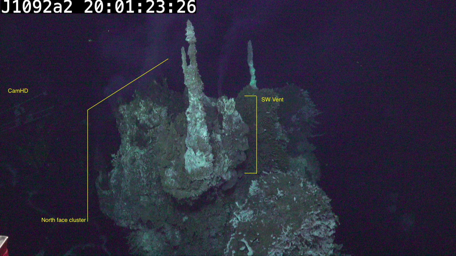 Looking West and downward from above vent
Proposed Placement for InVADER
Based on the currently available information, the prominent north-facing
region at the crown on Inferno, or perhaps the nearby NE vent cluster, fulfill the requirements for InVADER.
It contains direct venting, including chimney growth and regions
free of biological growth. It is relatively accessible, on a convex surface
away from the side prominences.
One concern is whether the profile of the North face makes it difficult to
site the instrument without requiring that it be above the vent looking downward.
This might be addressed by focusing on either of the concave valleys
either to the East or West of the ridge. For example, if Invader was placed
to the Northeast side of the vent it may have sight of both the North face cluster as
well as the NE vent group.
Calculating scale
The major question in finalizing InVADER placement is selecting an ideal height for targeting regions of interest based on the video data.
A significant issue with image-based structure estimation is the inability to quantify scale. This deficiency can be addressed a number of ways: through the use of surveyed fiducial marks or objects of known size, through collection of stereo imagery with known inter-camera geometry, or with other supplemental data which provides metric data on camera motion.
A best-estimate post-processed navigation solution is available from JASON post-dive. The solution takes into account sensors on the ROV as well as data available onboard the support ship, including GPS and acoustic range-based location estimates.
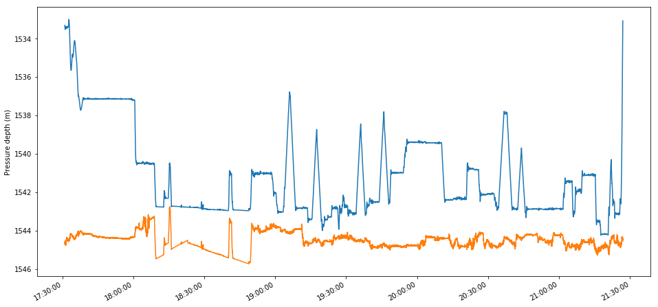
The depth profile for the full time on the bottom is shown below, with depth in blue, and estimated bottom depth (depth + altitude) in orange. The errors in bottom depth in the first half of the mission (between ~18:10 and ~18:50) are outside the time bounds of the survey of Inferno and are ignored…
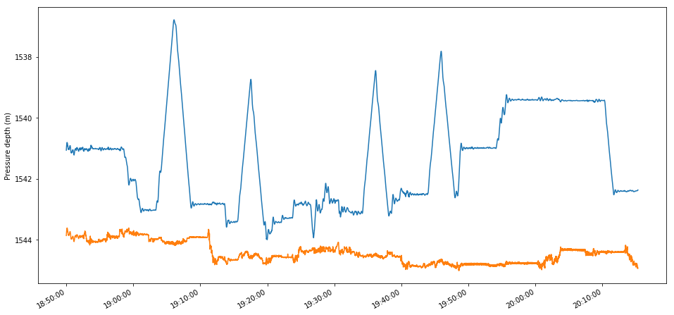
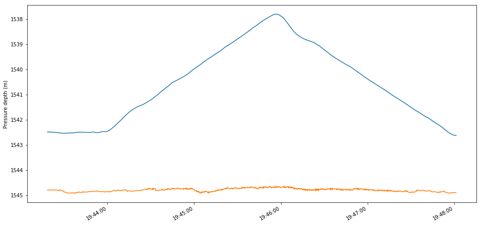
The depth profile over the extent of the “Survey of Inferno Vent” movie can be extracted:
As shown, the “survey” of Inferno consisted of four full bottom-to-top-to-bottom transects of the vent. After the fourth transect, the ROV hovers at mid-vent height for a few minutes then ascends to the top of Inferno (at ~19:55), where it completes a 270-degree orbit of the vent (the “Orbiting crown of Inferno” video.)
The fourth transect (between approx. 19:45 and 19:49 GDT) surveys the northern face of the vent seen in the “Examining North face of Inferno” videos. Examining this transect in particular:
This data sequence can be resampled at the video frame rate and overlaid onto the video as subtitle, as shown here (.mov file @ 6.6GB). The estimated
depth / altitude values are as calculated by the Jason team and do not
(yet) account for the offset between the ROV’s nav solution coordinate
frame center and the camera center, which may be as much as a meter.
It is at best a coarse estimate of the height of the camera above
the seafloor and does not account for the up/down tilt of the camera.
Revision History
17 April 2019: Initial version. 24 April 2019: Updated text. Reworked video subtitles using renav data. 13 May 2019: Added link to Further images from North Face.
