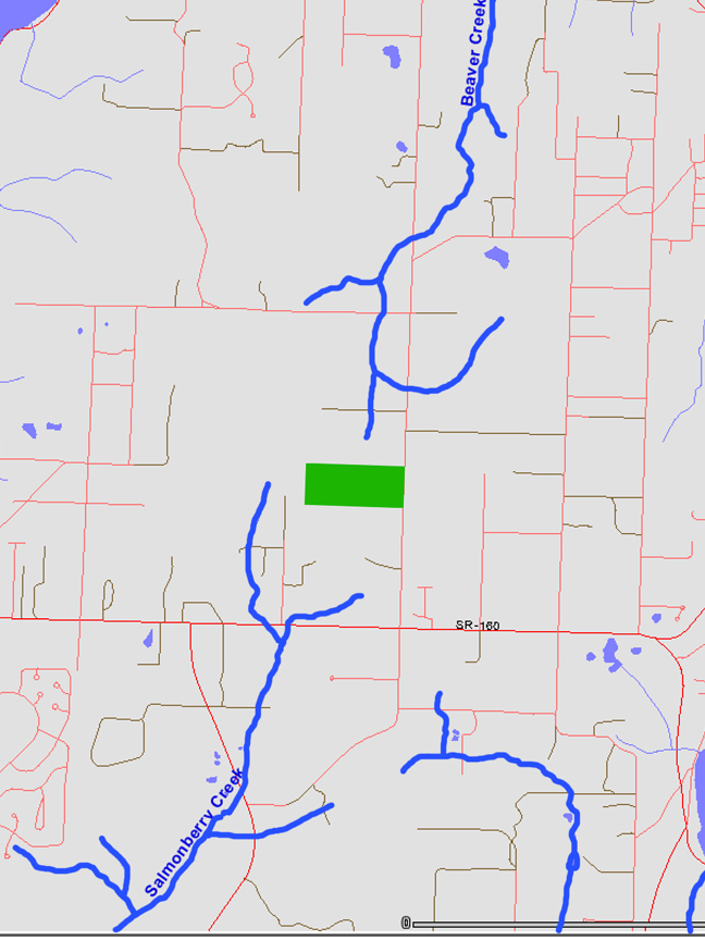
| This is what we have from GIS, with a little tweaking on my part. I've marked where our forest is in green (green) and made the streams wider in blue (blue). What I see in walking our forest is that there is a stream on the front and back of our forest and neither is listed on the map.
So why should I care that the streams aren't on the GIS map?
I care because GIS mapping is how governments are managing our land. They know what is there because they can go on their computer and see if it is there. Knowing it is there means that it is more likely to be protected correctly.
If I want a permit to build on the land but there are wetlands there, if they aren't listed on GIS how will the local government know to not allow development? Only if the areas are show will they have a little better chance of being protected.
|