
Last Friday Jeff, Ed, and myself met up at a Bellevue park and ride to carpool down to the Esmerald Basin trailhead to tackle this scrambling monster known as Mt. Stuart.
This was probaby my most ambitious hike to date, and I knew Jeff and Ed really drooling with anticipation as well, so it had all the makings of a great weekend excursion.
We got into the trailhead at, I believe, 7pm-ish. We decided we would spend Friday evening hiking up the 1.5 miles to Longs Pass (6250ft), dropping down about 1500 ft of elevation on the other side into some campsites at the base of Stuart. Then Saturday we would scramble up Stuart, come back down, and hike out that evening. Sounds pretty straightforward right?
Our hike up to Longs Pass was pretty uneventful. There was plenty of horse dung on the trail to keep our senses of smell finely honed, and we noticed what was probably a horse trail leading up towards the top. It looked like an old road of some sort, not sure who would be driving up here though.
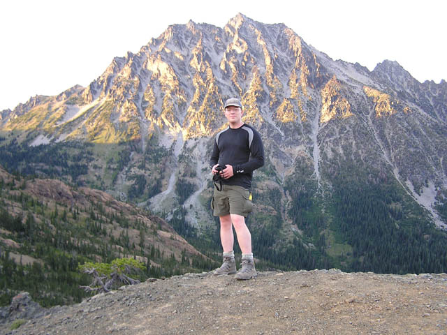
From Long's we got a nice vantage point of our objective, right in time for the low setting of the sun to shine on Stuarts spiky, rough hewn visage. Stuart isn't a pretty looking mountain IMO, but it looks about as hard as it is to get up the beast. So we were under no illusion that this was some Sunday stroll through the Rose Garden.
I was comforted with the thought that I wouldn't find any baby strollers or fidos prancing around at the top to make me realize how easy this hike would be, because it wasn't easy.
We sucked in the nice viewage, including Dragontail and Sherpa Peak with an interesting rock seemingly balanced at it's top. A group of young whipper-snappers passed by us as we took a break, and we headed down Long's as well.
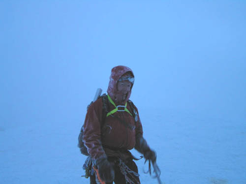
It was getting pretty dark by this time as we found a camp spot and bedded down at a little after 9pm.
Early Saturday morning we woke up, I had some Quaker Oatmeal, Ed had a Cup of Noodle, and Jeff had Fig Newtons?!! Sorry about that Jeff, had to get you on that one!
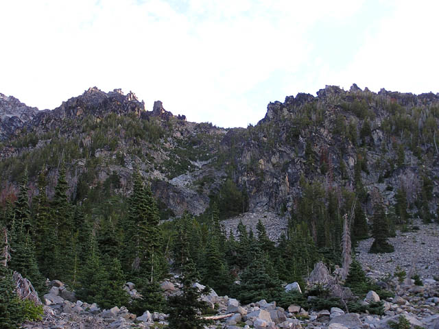
Anyhow, we were riding strong on the trail at about 6:20am. We took the first trail left up into Mt. Stuart but it was difficult to tell whether the trail led to the Cascadian Coulour, which is where we wanted to go, or Ulrich Coulour, which was the steeper, more difficult coulour to the left of the Cascadian as you're facing Stuart.
We hiked up a ways, and decided to come back down to the main trail and see if maybe the Cascadian was further down the valley. Considering the overgrowth and pine needles covering the trail we double-backed and decided that the trail we first went up was probably Cascadian.
We got up about 500 ft and realized the trail we were on was indeed leading up to Ulrich Coulour. We didn't want to have to go back down to the main trail a third time, so we made a decision to try the Ulrich and see if we could make the route up.
It was a good scramble through the Ulrich, but speaking for everyone on this trip, we were glad we did the Ulrich instead. It was manageable, and we would get a fresh perspective taking the Cascadian on the descent.
We bumped into another group of guys hiking up, with an older fella taking up the rear. He had been up to Stuart a while back, you can tell the guy was having a little difficulty getting up, but he kept plugging along. They asked us if the gulley was the Cascadian, I guess they had made the same mistake we did. We told them that it was Ulrich, and they were concerned if there was some technical spots to get through up ahead.
I had read a little bit on Ulrich and remembered it only cautioned more loose rock and steeper terrain than Cascadian, and informed them that they could get through. I told them that if they saw me hurtling down at about 80 mph's past them on the way up then turn back.
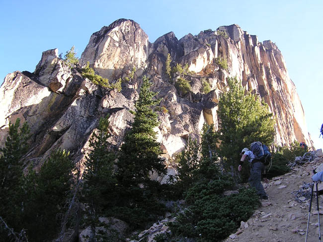
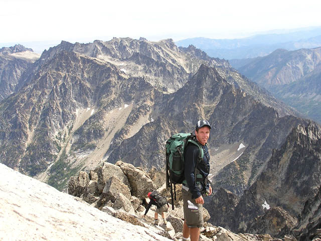
We finally got to the top of the coulour where it intersects with the Cascadian. It was our first clear view of the Cascadian, and judging by the size of the gulley it was the indeed the obvious route. After a brief rest we continued up to a small snow field leading to the 'false summit'.
I think all of us had read TR's separately on the precarious nature of ascending that snow field. It was much smaller this time of year, but definitely dangerous and very steep. There was a free rock slope to the left of the snow, and that's where we decided to hike up. There was alot of loose rock. I was almost pulverized by a falling rock bigger than my head, which broke up into many pieces right before it got to me.
I decided NOT to follow my hiking buddies straight up, which is what I probably should have been doing all along, and take a parallel path to their left. It ended up requiring more climbing than I wanted to do, but I finally got to the false summit to see a medium sized group of hikers preparing for their summit attempt.
I lost sight of Jeff and Ed, but the hikers informed me to continue to my right up a rocky rise to find them. I located Jeff and we scrambled along the side of the rocky rise rather than climb to the top. It required a momentary shuffle around an exposed rock, but we both made it across.
We had no idea where Ed was, but soon located him a bit ahead standing on a rock. Ed yelled back to find us and he soon located us in the shadow of the rise.
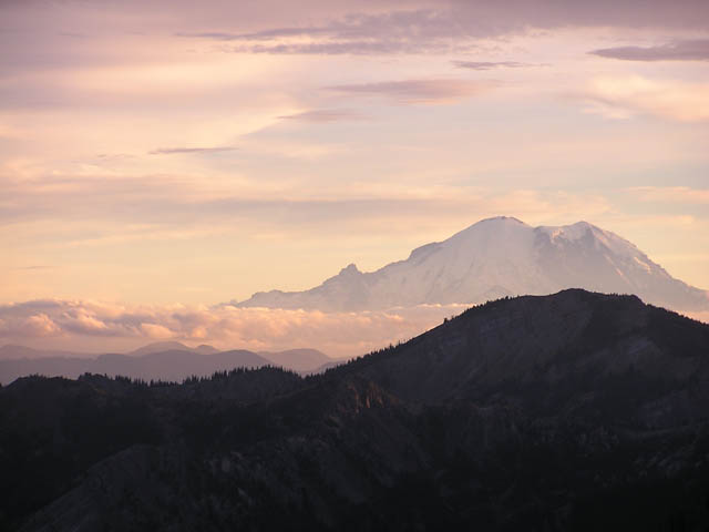
One thing not many TR's mentioned about Stuart is that the scramble from the 'false summit' to the 'true summit' is quite a, well, scramble. I guess with most mountains I hiked I figured 'okay I got to the false summit, now I can salsa my way to the top'. Stuart wasn't going to make it that easy on us. As we scrambled up from the false summit I could look down the other side of Stuart and saw the Ice Cliff Glacier sitting way down below us.
Ed was sitting pretty on the summit for a good time as Jeff finally got there, and I took the rear. We found the niche at the summit, relaxed, and took in the clear views in all directions. The very top of the summit was an angled slope with a long dropoff on the other side.
I saw Stuart Glacier sitting at the base, and the summit peak cast a nice shadow over the glacier. Stuart Lake was fully visible as well, and Horseshoe Lake, which Ed said he had hiked to previously (I believe).
The other group with the older fella finally got to the top in good spirits. He remarked "just as I remembered it!" as if he did the entire trip to make sure everything still looked the same.
An uber-organized group of hikers were scrambling up so we decided to take our leave back down. We got down the false summit with no delay, and the previous group told us it was easier to get down the slope with the snow if we stayed farthest to the right of it. I took their suggestion, and Jeff and Ed skirted the edge near the snow.
We decided to take the Cascadian Coulour down. It was a bit longer than I thought it would be, maybe my bad case of diarrhea (don't ya love these details?!) had something to do with it. Ed got to the base very quickly and told us he'd be waiting at the Meadow at the bottom.
Halfway down the Coulour we found the trail that actually runs down the ridge finger adjacent to it. We got back to camp and before we had a chance to relax too much it started to rain a bit.
We got our gear together and headed back up Long's Pass (5pm-ish). At this point I was exhausted. I told Ed and Jeff to go ahead as I wanted to find a pace I could live with without doing a faceplant on the trail. Thankfully I brought a couple of Gu packets, which kicked in as I was nearing the top of Long's Pass.
I eventually caught up with the guys on the descent back down the trail and we made our escape to the trailhead, getting back around 8:45pm. Thank God for a clean pair of socks!
It was a tough trip overall. There's no easy way down like many other mountains. You scramble up, you scramble down, so be prepared. I have to admit I got spoiled glissading down Adams and St. Helens in the previous weeks. Mt. Stuart would definitely be nicer hike with a bit of snow to slide down, though undoubtedly more unpredictable.
You won't have any need for crampons or an ice ax, but bring plenty of water. Ed and Jeff went through 3 liters each, and I had a bit more, but we all ran out halfway down the Coulour.
One more suggestion: Personally I wouldn't recommend trying to hike up Stuart (from the campsite, not the trailhead) and back to the trailhead in the same day, unless you are in really good condition and you start really early. I had more of a problem with the hike than Ed and Jeff, but taking the extra day would make the experience way more enjoyable and less rushed.
Overall it was great to do such a challenging hike and scramble. There's no wonder however on why so many people need to be helicoptered out of that place due to injury. I was glad I made it up and even moreso back down. A definite must on your list of trips to consider!
Chris


For those hikers that want to get a good idea on how a hike 'will be' looking at my gallery will give you a decent idea. I always post my pictures in the order that they were taken along the way and I try my best to present the areas of interest (or concern) if you are planning on taking up this hike. If my galleries help you in some small way in the future then i'll have been doing my job. See ya on the trails!
Chris Dessert
Last modified: 10/07/2004 12:29 PM