Mt. Persis 1/29/05
I had been thinking about getting up near Index for a couple of months now and figured since the snow levels were down here’s my chance. I definitely needed to get away from civilization this weekend and find some quiet solitude or at the very least some stormy, rainy solitude. I got to the Persis trailhead at about 11am, seeing that if the forecast stays true to early afternoon sunbreaks would be in my favor.
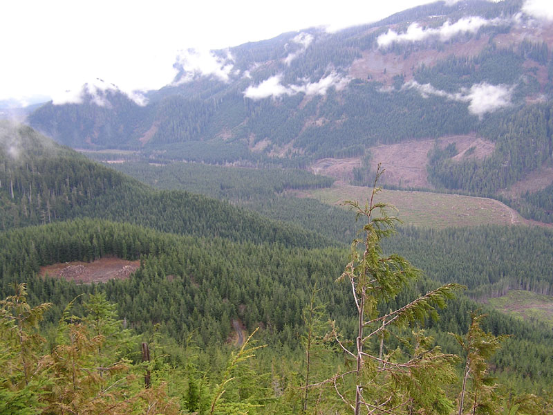
It was the first time I had been up around this way and I was a little disgusted with the amount of clearcut forests driving in. There was a guy actually living out among the clearcut backroads in a mobile home. I wondered casually if he was some serial killer as I drove through. Arriving at the trailhead I saw there were only two cars, which was fine with me.
According to some trip reports I read earlier I was advised to park my car a few hundred feet short of where the actual trail begins. Supposedly the road leading to the trailhead was narrow, but don’t believe the hype, there was good places to park and it saves some hiking time as well.
The trailhead is marked with orange tape and starts off pretty steep, having to lift myself past a few blowovers. It wound it’s way upward through a (surprise!) clearcut. I could see that it was pretty misty at the top of the ridge but I was still holding hope to get some kind of views.
There were quite a few trees strewn across the trail and I had to go around and squat under a number of them. At around 4200’ I encountered a party of 4-5 hikers. I was a little surprised that they were much older considering the cars at the trailhead seemed to be of the hotshot younger guy variety. At this point I was able to get a decent view of the parking area and all the beautiful clearcuts down below, but the fog only gave me a moments glance before it hazed over again.
I was happy to have recently gotten my GPS back from Magellan after I accidently deleted the entire memory. So I really didn’t need it on this trip but separation anxiety caused me to bring it along, and it worked well I might add!
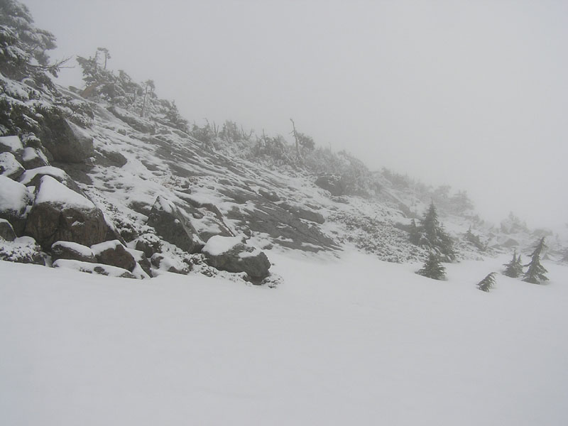
Snow levels began at about 4500’ but the fog didn’t allow views of anything. I soon gained the ridge to Pt 4974(?). With no view I couldn’t see how far the drop was to the north, but it looked like a ways if I were to slip. I scrambled across a wet rock field just below 4974 but I looked downhill and saw a snow trail that some smarter hiker used to bypass this area.
The trail moderated as I hiked across the ridge to the Persis side. Some horrible hail started coming down really hard, turning into rain soon after. It seemed like every time I took a minute to dig my rain jacket out of my pack the rain subsided. Then I geared up and began to move, THEN the rain started coming down again! Then I pulled my rain jacket out again, and you know the cycle from here!  You’d figure I would just say screw it and hike in my rain jacket regardless. But those jackets are like furnaces when you heat up as much as I do.
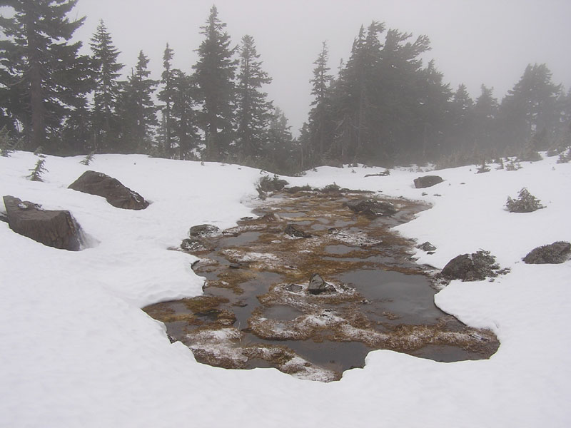
I soon got to the Persis side of the ridge and it opened up to some nice fields of snow, with a exposed tarn or two. According to the TOPO there was a flat area just south of the summit with a couple of tarns, but I stuck with the edge of the ridge going north and only got a slightly obstructed view of the tarns as I made my way to the summit. I could have actually used my new MSR Denali Ascent snowshoes (which I have been itching to do!) during this last part, but why hassle with the weight? The way this season is looking I’ll have to wait a year to get the opportunity.
Between the snowfields and some snow encrusted brush I gained the summit, at about 2:00pm (5464’). It was cold, there was absolutely no views except for the cliff immediately around me, and my gloves were soaked (wah wah wah!). I waited around and explored the immediate area in the hopes that the fog would lift. For a minute or two I could see the Sun’s outline fighting through the mist, but it was not to be. So no awesome view of Mt. Index, no views of the valley below.
I made my way to the north edge of the summit, closed my eyes, and I could actually ‘feel’ the wide open space in front of me. Then I lost my balance for a second and fell 1000ft to the town of Index! No, just kidding, but it felt like I might, so I scooted back. I was hoping to find a nice looking cornice or two but I think the rain had loosened up any overreaching snow.
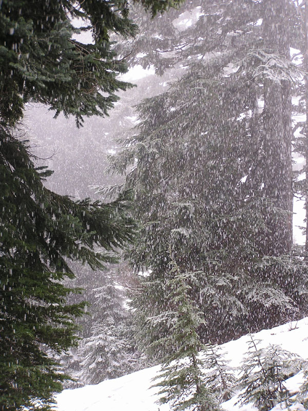
I decided to head back and that’s when some light, fluffy snow began to come down. I felt like I was in a Christmas movie. Plowing down the gradually increasing snow was great.
Of course in the great tradition of the flaky rainfall the Sun came out after I was about 200 ft down from the summit on the way back. But my sunny nemesis didn't count on the determination of one Arlington-based picture freak! So I hiked back to the summit but there was still no views of Mt. Index! I screamed my Hollywood best at the Sun,"I'LL GET YOU NEXT TIME!!!" Then headed back down.
The hail made an encore appearance then back to snow, but this time heavier and harder. I found a couple of shortcuts on the path back, but other than that it was foggy and uneventful.
Specifics:
Distance – approx. 2 miles
Depart: 11:15 AM
Summit: 2:00 PM
Time: 2:45 up
2:00 down
Elevation:
Trailhead - 2860’
Summit - 5464’
Gain – 2604’

Last modified: 8/02/2005 8:13 AM