
This loop trip is the jewel of all my travels in this state. A loop with so much bang for you buck you will come away feeling like you robbed Ft. Knox. I had been singing the praises of this hike to my little brother since I did the hike last year. This is THE HIKE. Enchantments my ass! Lyman-Buck is where it's at people!!
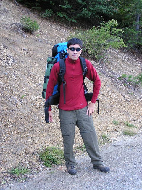
We car-camped at Trinity, but we didn't get much sleeping done as we were freezing our arses off. The plan was to drive up to Phelps Creek trailhead, hike the loop, and we'd come back through Trinity and back up to Phelps to get the car. I lost the coin toss, so i'd be getting the car when we got back in.
The first day was pretty straightforward, we hiked out to Spider Meadow. The forecast was calling for rain, but we lucked out with some cloud cover and nothing falling out of the sky yet. There were a few cars at the trailhead, but when we got to the Meadow we saw only a couple of tents. Having been out to Spider Meadow a couple of times I was disappointed that my brother didn't get the great weather and clear skies that really make the experience truly remarkable, but it could have been worse.
We arrived at the Meadow and the rain began to gather, so we figured we'd stop here and set up our tent for the possibility of worsening weather. After hanging out in the meadow for an hour, and it was still early, we took the tent down and decided it would be better if we got up into a campsite up near Spider Gap. It would save us precious time later on in the hike and possibly give us an entire day at Buck Creek Pass to explore.
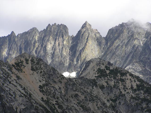
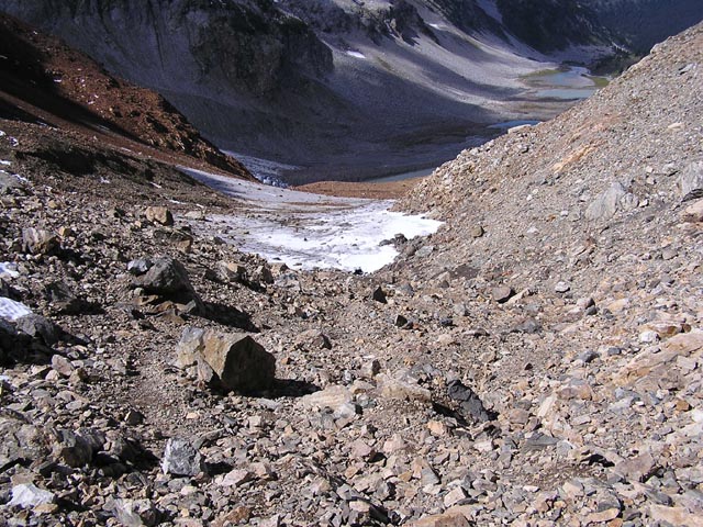
The meadow provided us with plenty of open space to try to pick out the trail up to Spider Glacier, but the trail always seems to be hidden so well among the rocks and hard to eyeball from below.
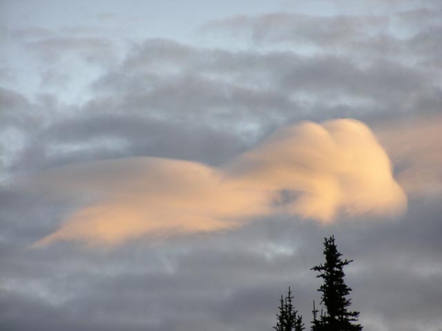
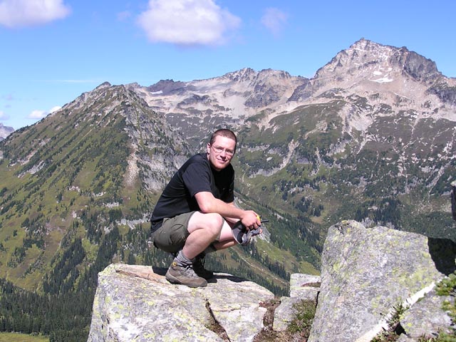
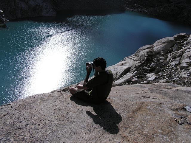
Thankfully the Sun started breaking in and as we elevated up toward Larch Knob we couldn't help but look back and look back often at the view of meadow in it's entirety. We reached Larch Knob and found a great flat campsite that was close to the rock's edge view of Spider Meadow. My brother excitedly pulled his camera and tripod out to get pictures of Spider Meadow as the shadows of Red Mtn and the adjoining ridge fell over it. You don't talk much when you have incredible views like this, you just grab a seat and stare off into the open. It's hard to break free from moments like that, but dinner wouldn't cook itself, so off I went.
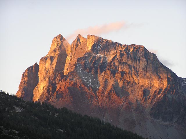
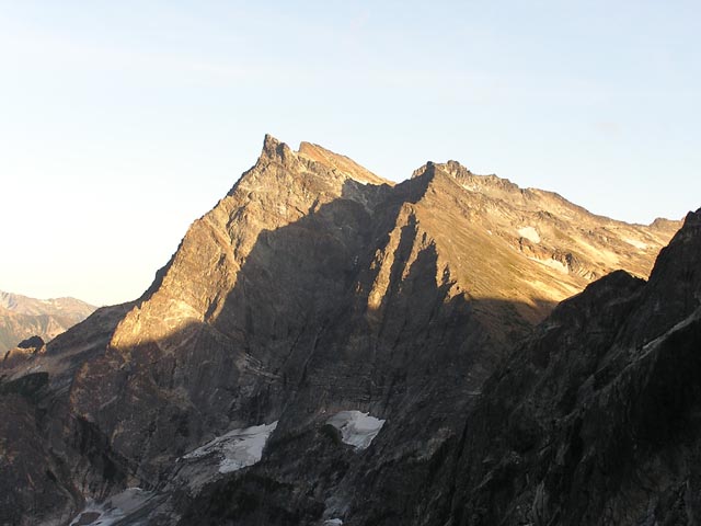
We ate our meal, set up for bed, and in between we had brief flurries of appreciation as the Sun cast on Seven Finger Jack and Mt. Maude on the opposite ridge. We debated the merits of the unnamed mountain adjacent to Spider Glacier and it's superiority to the 'named' neighbor Red Mtn.
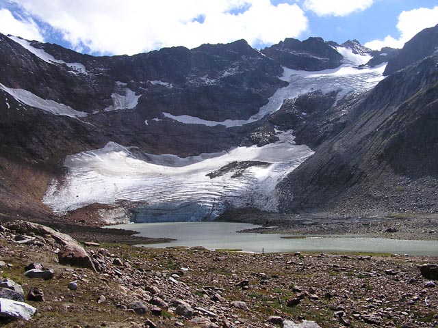
Sadly, it seemed Spider Glacier had lost some of it's mass since last year. From the base I could see that last years uninterrupted mass to the top had been melted down to rock at intervals. At the base there were 10ft deep crevasses running lengthwise up the ice. I visually compared in my mind it's current state with pictures I had perused from last year and the decline was clearly apparent.
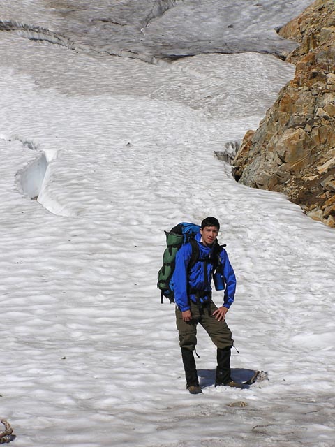
There was a few campers up at the knob, but Sunday morning seemed to wash most of them away, and we got up with renewed purpose in our preparations into our journey into the Lyman area. My brother had never been on a glacier and, given it's current state especially, Spider Glacier just barely qualified. We got started late but it gave the glacier a chance to melt and provide good footing for the path up.
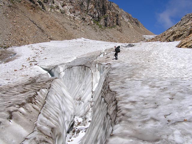
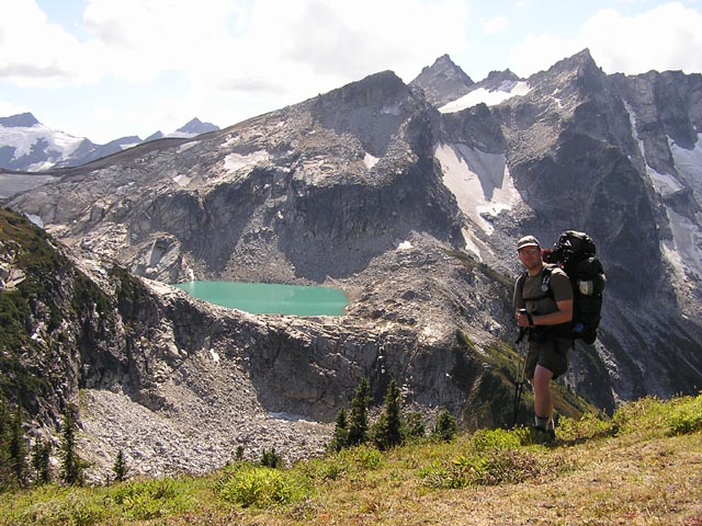
We had a brief scare as I asked my bro to take a shot of me a little too close to a nasty looking crevasse. I slipped and caught myself with a knee and carefully pounded steps away from the potentially offending maw. We did more scrambling than I would have liked, through all the exposed rock that used to be filled by a previously more robust glacier. I caught the sound of a vigorously moving current. We both realized that there was a pretty strong stream running underneath the upper portion of the glacier. The upper terminus of the glacier feeds into a bowl of rock. We rounded up a bench to the 'technical location' of the Gap, but decided to stop short and take in the half-views of Dumbbell Mtn and the surrounding peaks.
There was a fire alert posted in Spider Gap proper, and we had our first real view of the Lyman Lakes and the surrounding meadows. I think in every real backpacking trip there is a 'point' that you reach where you feel like you are truly 'getting away' from civilization and entering the 'real nature'. This was only my 2nd time over the Gap, but this was my imaginary demarcation line. It felt like HERE was where the trip really began, and I felt free. An emotional weight as oppressive as the backpack on my shoulders just lifted out and away. It was beautiful.
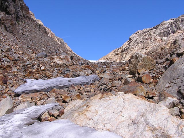
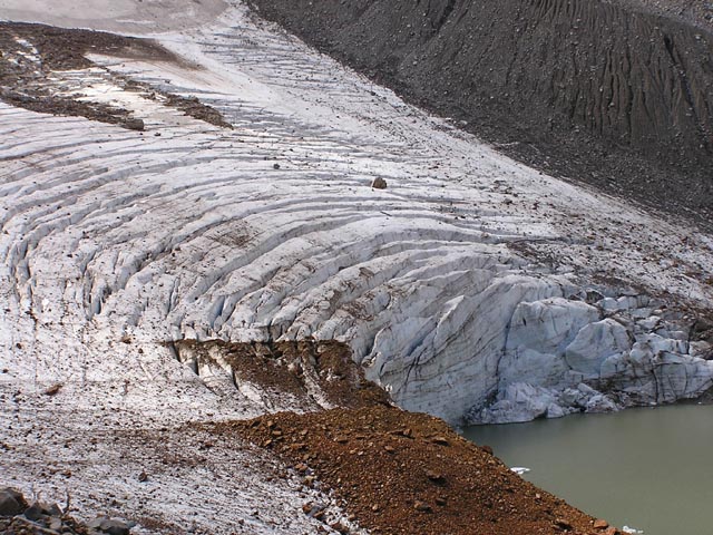
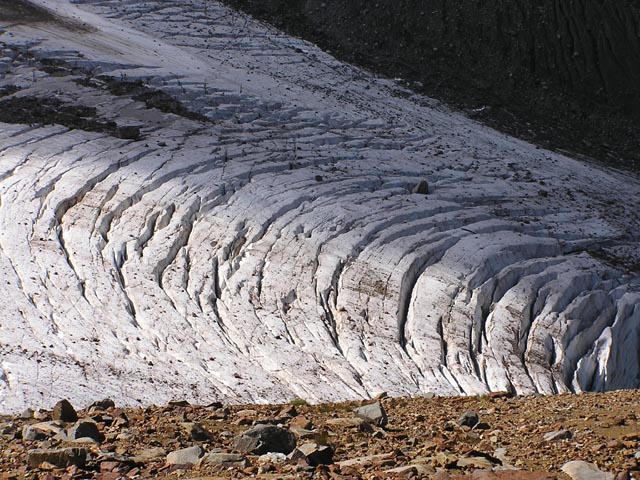
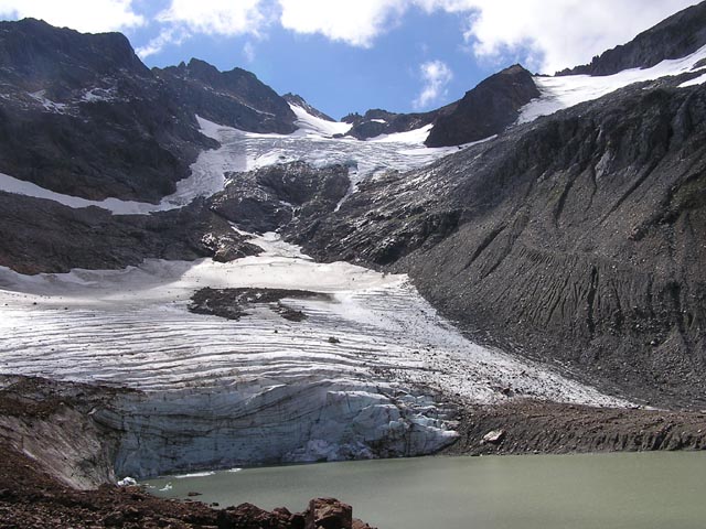
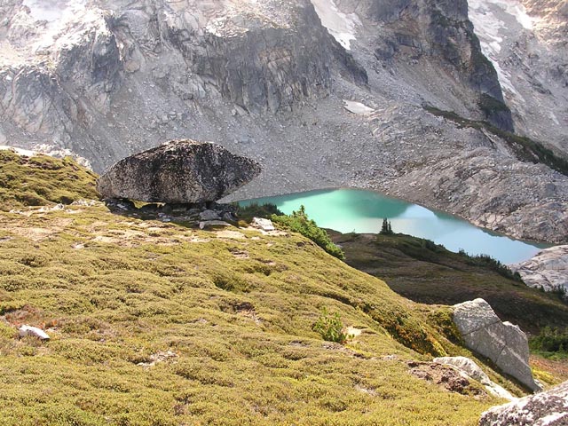
We found a wooden sign warning of fire danger on one of the trails. It wasn't where we headed so we payed it no mind. I had noticed that the Lyman Glacier had retreated down the slope a good ways. Last year I had glissaded down almost the entire slope to the rocky bottom. Today we had to scramble down a ways before reaching the icy glacier. No glissading this year. It was too icy and it had melted down to rocks in various locations.
We got about halfway down the glacier and realized it would be much safer to move laterally to some rocks and scramble down those instead. There was an old lady at the base. She was sent by the Forest Service to retrieve the fire warning sign at the Gap. She saw the trouble we were having coming down and thought better of trying to go up the glacier.
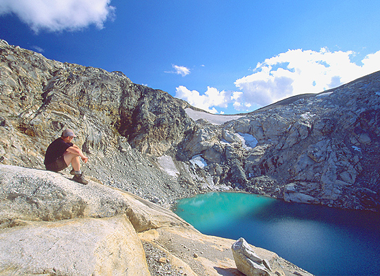
We ascended down to Upper Lyman Lake at 'break ankle' speed. The site of Lyman Glacier, with all it's character cracks, feeding into the lake gave us that extra inspiration to be by it's side as soon as our pedalers would allow. There was something about the lake that seems to exude an almost primordial energy. I felt that when I had come down to Upper Lyman that I had entered the tomb of some long lost king. I wouldn't be so surprised to see the Lady of the Lake rise with Excalibur in hand from it's waters. Needless to say that area has a spiritual presence to it that I can't quite place or put to words.
My brother, on the other hand, wasn't having quite the 'spiritual experience'. We got down near the water and the shoulder strap on his backpack broke. I brought a couple of spare buckle straps, so we were able to provide a temporarily fix. Once we settled, we sat in awe at the great views all around us. The cracks and crevices of the lower portion of the Lyman Glacier. The upper hanging glacier was an interesting sight. It had built up into a 'bulge' at it's lowest portion, and we figured it must be strong and compact to defy gravity as it did, just hanging high up on the ridge.
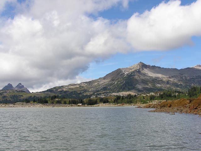
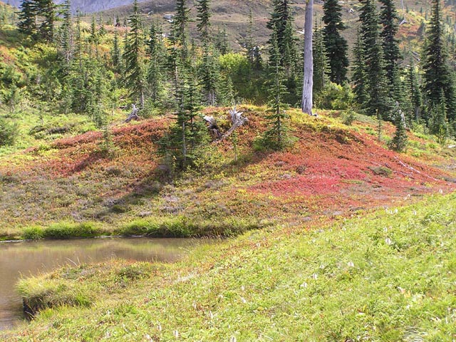
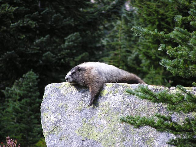
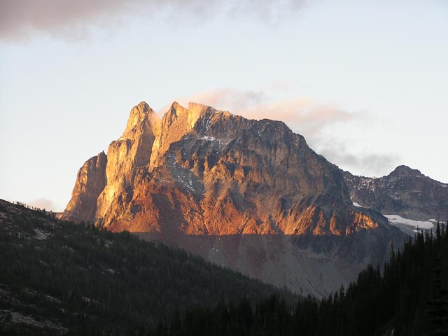
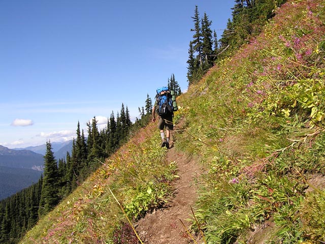
The hike down to Lower Lyman Lake was a wonderful stroll through multicolored hills and ripe blueberry bushes lined the trail downward. Another camping party had secured an enviable spot on a hill covered with fiery reds and bright yellows. We continued along the trail and spotted a marmot laying out on a rock like a seal. He didn't bother to budge from his spot even as we inched closer into any lesser animals comfort zone. We got a preliminary view of the great Bonanza Peak, the tallest non-volcanic mountain in the state.
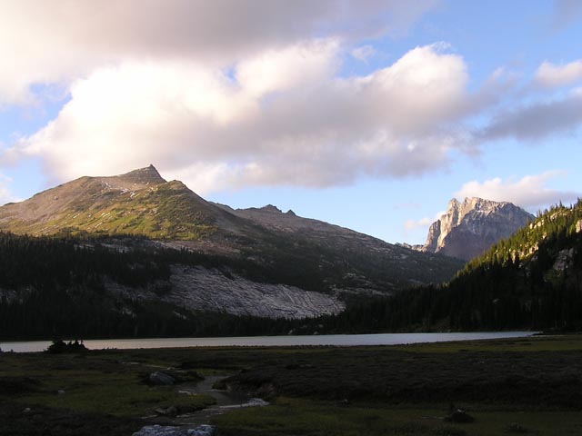
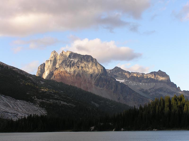
We found an established site just off of the lake and decided to hike out to the other end and see Lyman Falls. As we rounded the circumference of the lake Bonanza Peak soon came into view. It was a dominate feature on the horizon, with a thin veneer of fog trailing off it's peak as if it were a Spanish Galleon moving through calm, misty waters. The incredible orange hue at it's base lit up as the sunset lay across it's surface. We passed a grassy pond and Bonanza reflected on it's surface. The picture was not to be as the breeze settled in, obscurring a calm reflection of the mountain.
My brother, ever the shutterbug, stopped to get some choice shots of scenery, so I scouted ahead to the Falls on my own. I was grateful for the momentary solitude as I arrived to the running waters of Lyman. I found a boulder and sat with my eyes closed as the gentle breeze glided across my face. 15 minutes later, which seemed like hours, came and my brother caught up. The light of the sunset over Bonanza became even more intense. The breeze subsided, and the conditions were perfect. My only regret is that I was so caught up in capturing a good picture that I didn't just lay on the grass and marvel in the view for what it was.
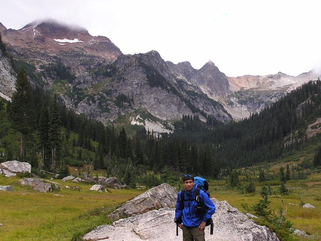
We made haste back to camp, grateful for a good night's rest after the last two nights hikeage. The next morning came early as we needed to hike the longest leg of the trip up to Cloudy Pass and Suiattle Pass and then a significant elevation drop from Middle Ridge and subsequently up to Buck Creek Pass. If we could get to the Pass by the end of the day it would give us an entire 'extra' day to explore the area up near Liberty Cap and possibly Buck Mountain.
Luckily the Sun came out in full force and we made our way up to Cloudy Pass, with it's impressive meadows and plethora of colored flowery fields. I briefly contemplated the merits of bagging Cloudy Peak while we were on our way up, but it would have made a long day even longer, so I filed a future trip in my mental diary. I scrambled up a rise next to the Pass proper and discovered that a trail led a good ways down up to the connecting mountains. I even got a brief glimpse of Glacier Peak.
We got a good viewing of Plummer Mountain and Sitting Bull on the backside of Cloudy, and fantasized about climbing the adjoining twin prominent peaks near Sitting Bull. The middle leg of the trip was an unimpressive stretch, mostly hiking through a wooded trail with limited visibility. Our only respite was the reliable supply of blueberry bushes following down most of the way. The lone bright spot of this day was a trail junction with Image Lake, which we decided wouldn't be a feasible side trip as our goals of reaching Buck Creek Pass was foremost in our minds. We reached the crest of Middle Ridge and took extended breaks. My feet were killing me and my brothers backpack strap had come undone again, causing him some shoulder pain. We came to an important team decision: Now was the time to break open that reserve pack of Pemican Teriyaki Beef Jerkey!
An infusion of Pemican proved to be the motivation that would take us over the hump that day my friends. We reached Buck Creek Pass just before sunset. Right before we climbed up to the Pass I was disappointed to see that the best blueberry patch of the entire trip had been 'cleared out' by Rangers seeking to improve the trail. Last year it was a goldmine of ripe blueberry heaven. Now every bush had been hacked and removed. What a shame!
Luckily a great spot of solitude was available, and we soon found out that Monday was a great day to be here as there wasn't another single soul in the entire area that night. The Sun cast itself over Helmet Butte, but Glacier Peak refused to clear it's cloud cover. The bright yellows showed their brilliance in the large meadow laying on Helmet Butte's enormous side. I spotted 3 deer further downrange, 2 adults and a deer-child grazing away. The views from the meadow was hard to describe, always breathtaking. It's like an enormous natural living room. Just grab a seat right on the trail.
To your left you have a number of peaks lined perfectly in a row: (farthest to closest) Buck Mtn, Mt. Berge, Mt. Cleator, and Liberty Cap. Buck Mtn was always distinctive with it's 'crown' peak jutting forward like some sentinel in the stardust, and the Liberty Cap, with it's green backside and 'head' that lended it the look of some naturally built monument. To your center, and the primary attraction of this spot was Glacier Peak, filling nature's TV set from side to side. It seemed so very close from this spot and so ideally placed for our viewing enjoyment. To the right sat the Flower Dome, and it's side of bright colored hues. The way the flowers and colored bushes blended into the Dome's sides it could have been a painting.
We ate our best meals and hit the sack quickly. Unfortunately the rat population decided to acost our tent throughout the night but after we loaded all food articles into our sleeping bags they soon gave up and went back to their holes.
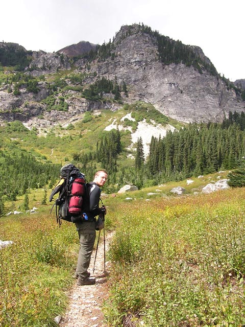
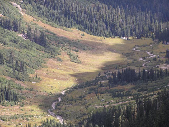
The next day proved to be another great, sunny day with clear skies. I had been out to Buck Creek Pass three times and for one reason or another I wasn't able to make the ascent up into the lovely top of the rounded pseudo-mountain known as Flower Dome. No, I didn't get my chance this time either. We were running behind schedule and we wanted to save our energy for the hike up to High Pass, and back out to the car tomorrow. Our route was simply, hike up an established trail up to the closest peak, Liberty Cap, THEN skirt the ridge trail to High Pass. From our campsite the trail lines were clear along the green slope of Liberty. We dropped down to established campsites at the base of the Cap and resupplied our water. There were Marmots ALL OVER THE PLACE. It was Tuesday so the entire camp area was deserted, which was fine with us. We couldn't find the trail leading up so we decided to just scramble up the brush till we ran into the trail.
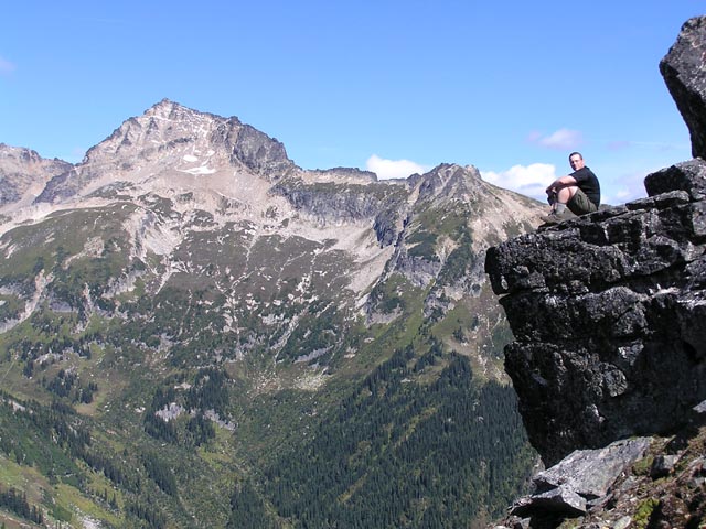
Well the scramble was easier said than done with a full backpack on. We were slipping and sliding our way up and everytime we thought we had gotten to the trail, it was nothing but a small marmot path. But we finally found the trail and it wound around the backside of Liberty. This was great, as I had never been on the backside of this mountain range. It provided the clearest, most unobstructed view of Glacier Peak. We made a semicircle around Liberty and the views of Buck Creek Pass below and Fortress Mtn in the distance were great. I briefly (don't I always) considered scrambling up a side path to Liberty's peak, but thought better of it. We got to this neat ledge, which dropped down hundreds of feet. I carefully tiptoed to the edge and my brother got some great shots of me sitting there. It was sloping down so I was never quite comfortable. We hung out taking shots of the Fortress, Helmet Butte, and the valley below. All of a sudden I heard what only could be the SONIC BLAST of a jet. It seemed pretty damn close. My brother spotted it, it was an A-6 Prowler and it had dipped down into the valley. We were actually higher in elevation than the jet! It didn't surprise me that those Navy flyboys were out here messing around. We had some lunch and dipped into our dangerously depleted Pemican supply. We spotted the A-6 as it was flying around much higher up in the sky this time. I wonder if those pilots could see us? Maybe they could give us a ride back home.
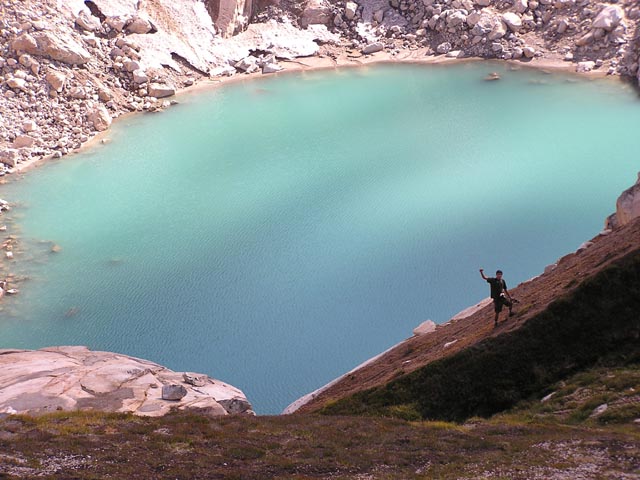
A nice waterfall came into view as we scrambled the rock field behind Mt's Berge and Cleator, toward Buck Mountain. We could see the waterfalls source was Triad Lake. It was blue-green and it's surface was glistening in the Sun, quite a sight up here in the mountains. We could barely contain our enthusiasm. There were rock mounds perched above Triad and we hung out on these, just taking in the lake and the warm sunshine. My brother scrambled down near the water's edge to get some pictures. I messed around with a rounded out rocky area, just scramble over and around rocks, trying to find a good perch to hang out. My brother scrambled back up the ridge and I got a great shot of him along this cliff edge above. I could have killed off an entire day just laying out in this area. It was definitely a highlight of the trip.
Continue down the ridgeline, we ran into an unstable slope of rocks, I was higher up on the ridge and my brother a few yards below me scrambling parallel. It was getting pretty sketchy as I pushed off of a large boulder to get higher up on the ridge. To my utter shock and horror, the boulder came loose and began falling down the slope toward my brother. Fortunately he heard me yell "OH SHIT!!" and he ran forward to get out of the way of it's path. It had happened so fast that we took a second to put our hearts back into our chests. It was very scary how so little pressure made this gigantic boulder go barreling down like that. I mean, I barely touched the thing and it came free like that. I should have actually known better than to have him scrambling below me like that. I guess we got tired and I wasn't paying as much attention as I should have to where he was going.
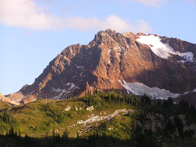
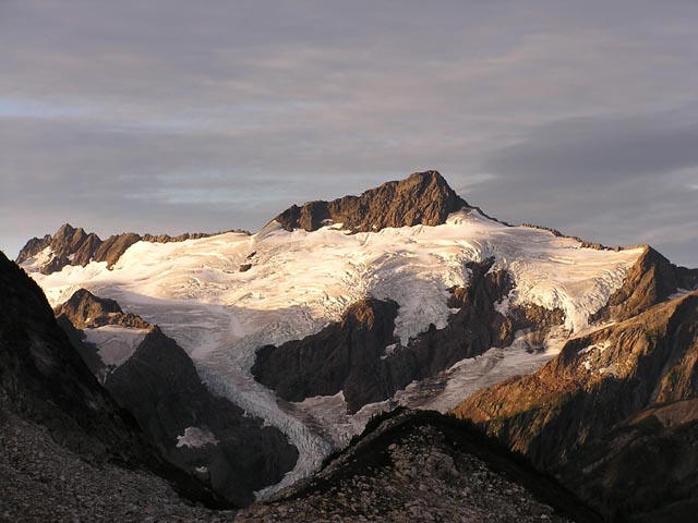
It was a full day of excitement and we finally got to a saddle between Triad Lake and the High Pass area. It was a nice open area, with a few flat, scrubby spots to set up camp. We decided camping on the saddle itself was just a little too windy and the lower High Pass area at least had some shelter from the wind. Clark Mountain just looked amazing in the distance. It was our first opportunity to catch a view of it, with it's glaciers draped around the summit like a shawl. We were beat, but this was going to be our last night before we hiked back into the trailhead, so we were in pretty good spirits.
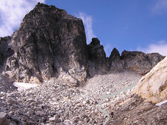
Before we called it a day we decided to scout out the scramble route down from High Pass, into Buck Creek valley. I had consulted the Beckey Guide before we left and there was supposed to be a route down from High Pass, which we would descend down to the valley floor. Then we'd have to cross Buck Creek and the trail out should be on the other side. It was pretty straightforward, but we wanted to get a good look at the route down.
There was a good patch of icy snow that we'd have to maneuver around and it was just rock slope city down the mountain. We hung out for a while, getting a good look at Buck Mtn, and just letting the wind pass over us. We saved our best dinners for the last night, so the eating was good. God this was a great location! It was quiet, enclosed, and with a front row seat of Clark. We soon got to bed and it was another uncomfortable night for myself.
We got up early at 6am the next morning. We wanted to have some extra time in case we ran into any problems on the way down.
NOTE: Work in progress...please check back for finished product later.
Chris


Last modified: 8/03/2005 8:09 PM