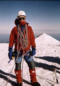
Columbia Crest, Summit of Mt. Rainier (14,411'), 8 a.m. July 10, 1994 |
Robert A. Norheim's work web pages
Time spent mapping mountains will
not be deducted from your life.
|

Overview: Affiliations | Current Projects | Past Projects | Background
| Masters Thesis | Contact Info
My work consists of supporting the research programs listed below with cartography, spatial analysis/GIS, remote sensing, field work, software testing, fire modeling, software development, data analysis, and more. I work in conjunction with research faculty and staff, graduate students, and Forest Service researchers who study climate change, landscape ecology, and fire ecology, and who need to effectively communicate their research with maps.
You may ask, how did I get all these affiliations at UW?
Our projects are funded by a wide variety of federal, state, and local
agencies, including the US Forest Service, Joint Fire Science Program,
USGS Global Change Research Program (Western Mountain
Initiative), NOAA, State of Washington Departments of Ecology, Fish
and Wildlife, and Transportation, National Science Foundation, NASA, Great
Northern and North Pacific Landscape Conservation Cooperatives, USGS
Pacific Northwest Climate Science Center, State of Idaho Department of
Fish and Game, Sound Transit, King County, NBII, FGDC, and others.
Here's a list of publications that I have spawned along the way as an author or co-author.
Maps I have prepared have appeared in:
I have also produced all of the maps for a number of books and
multi-chapter reports. Having all of the maps done by one cartographer
helps give the book a more coherent feel. These include:
- Development of maps for research papers, field work, public
outreach, presentations, proceedings, posters, proposals, reports, book chapters, theses and dissertations as requested by researchers and graduate students
- Spatial analysis, remote sensing, and field work for research projects in climate change and variability, mountain ecology, and wildland fire.
- I researched the quality of digital elevation models produced by LIDAR and INSAR airborne technologies
(link to paper)
- I performed software testing and support for the Fire Emissions
Production Simulator software.
- I developed a series of climate anomaly maps derived from the VIC model for display on a website.
Maps, spatial analysis, remote sensing, and field work for projects and publications:
- Modelling Fire Return Interval for the Columbia River Basin
- Tropospheric Ozone at Mt. Rainier National Park
- Tropospheric Ozone in Western Washington
- Subalpine conifer growth in the North Cascades
- Soil properties of subalpine parklands of the North Cascades
- Treatment effects of high elevation clearcuts
- Landscape patterns of the western Olympic Peninsula
- Spatial and temporal variablity of tree growth/fire/vegetation change/climate relationsships
- Effects of fuel treatments on fire severity
- Assessing spatial structure of fire regimes
- Analyzing impacts of sea-level rise
- Analysis of watershed initiatives
- Downscaling simulations of future global climate
- Climate change and watershed planning
- Climate-driven variability and trends in mountain snowpack
Technical Assistance for National Parks:
- Mapping Vegetation and Fuels for San Juan Island National Historical Park
- Social impacts of military overflights
- Traditional uses of cabins in Denali National Park
- Metadata for North Cascades National Park's geospatial and research data
- Metadata for geospatial data for small parks in the National Park Service Pacific West Region
- Metadata for Cabrillo National Monument's geospatial data
FGDC and NBII funded projects:
- Initial development of NBII Pacific Northwest Information Node (PNWIN)
- Initial cataloguing of datasets for PNWIN
- First and second versions of on-line mapping application for PNWIN developed with ArcIMS
- Metadata for Olympic Natural Resources Center
- Metadata for Graduate Student and Post-Doc projects
For more background details, see my resume and my publications.
Education:
Professional Memberships:
Some places I used to work:
My thesis examined two geographic datasets that were put together at about
the same time that map old growth forests in the Pacific Northwest. The
first is the dataset put together by
Pacific Meridian Resources for the
USDA Forest Service. The second was put together by The Wilderness Society
. Not suprisingly, the two datasets disagree. The amount of
disagreement is surprising, however, considering that the datasets
ostensibly map the same thing. I examined the differences in
techniques and definitions the two organizations used, as well as looking
into the agendas of the two institutions to see how the differing outlooks
may have contributed to the way the datasets were put together.
I have finally managed to get a publication from my thesis published in
a journal: How institutional context affects results:
Comparing two old growth forest mapping projects. Cartographica 38:3/4
This page has some information about my thesis,
including an abstract, results, references, maps, and more.
Committee:
Last updated: September 11, 2018