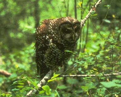
During the controversy in the late 1980s over old-growth forest and the northern spotted owl (strix occidentalis caurina) in the Pacific Northwest, the U.S. Forest Service came under attack for its estimates of the amount of old growth that existed on the National Forests in the Northwest. Using the Forest Service's own inventories, The Wilderness Society estimated that significantly less old growth remained than the Forest Service claimed. Seeing these numbers, Congress directed the Forest Service to perform a complete inventory and report back within a year. The Forest Service hired Pacific Meridian Resources to perform the work. The Wilderness Society decided to perform their own mapping project at the same time. Thus, during 1990, two independent mapping programs were being conducted, both with the same goal: to inventory and map the current extent of old-growth forest in the Pacific Northwest, so as to better inform the controversy that was going on at the time.
When the two projects released their results in February 1991, they produced very different figures. This thesis examines several aspects of the two projects, to try to explain the discrepancy, in the hope that an understanding of the projects' differences will better inform their use in the old growth debate. These aspects include the institutional agendas of the organizations, how the definition of old growth was applied, and the techniques used to conduct the surveys. The two datasets are then compared directly, to attempt to determine any regularities in the differences between the two projects.
Particular attention is paid to the acculturation process within the Forest Service, and the agency's traditional focus in providing a supply of timber, with which conservation efforts for the owl conflicted. The Wilderness Society's role as an advocate for the wise stewardship of federal lands and its reputation for carefully researching the issues it advocates are highlighted, as is criticism that the growth of the organization has caused it to become less focused on its role as an advocate. The backgrounds of the firm that performed the work for the Forest Service and the man who headed the Society's mapping efforts are also explored.
Pacific Meridian Resources used an innovative technique of interpreting Landsat TM imagery to conduct its mapping project. The Wilderness Society used two methodologies, photo-interpretation for the four forests examined in this thesis and classification of Landsat MSS images for other forests. Although the two projects both used the same definition of old growth, the two different techniques required them to apply the definition differently. In fact, Pacific Meridian Resources originally considered themselves to be mapping "potential" old growth, until told to remove the word from their maps by the Forest Service.
While the two projects ostensibly mapped the same area, there were differences between the areas actually covered. 11½ percent of the old growth found by The Wilderness Society on the four forests was in areas east of the Cascade crest not mapped by Pacific Meridian. 8.4 percent of the old growth found by Pacific Meridian on one of the forests was in an area not mapped by The Wilderness Society. Examining the difference in the old growth acreage found over commonly mapped areas thus results in figures that disagree even more than the figures that were originally reported.
A direct comparison of the data over the areas commonly mapped reveals no pattern to the differences. The rates of agreement over where there is old growth vary significantly across the four forests examined. There is not even any consistency as to how Pacific Meridian mapped areas that The Wilderness Society mapped as borderline old growth.
Various aspects of the methodologies employed are critically examined. The further uses that both methodologies and datasets were put to are examined, including the Gang of Four and FEMAT reports. Previous comparisons of the data are also surveyed.
In summary, the short timeline for both projects, the nature of the remote sensing devices employed, the differing geographic scope of the projects, the application of the old growth definition, the respective budgets, and the institutional pressures on the projects, all had important impacts on the ways that the projects were conducted and thus on their results. This thesis provides an understanding of how and why these aspects of the projects affected them, allowing for more informed usage of these datasets.